

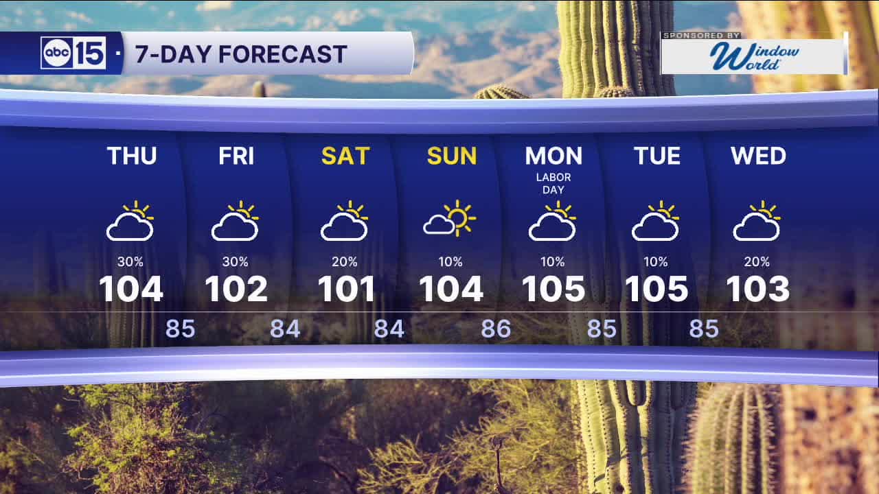


PHOENIX — After the second hottest summer on record in Phoenix, we're getting a break from the extreme heat this week.
Temperatures will stay near or slightly below normal with Valley highs in the low 100s this week. Overnight lows will be cooler too, dropping into the upper 70s to mid 80s across the Valley.
We are also tracking a big boost in monsoon moisture and the potential of tapping into some tropical moisture from Tropical Storm Marie.
Storm chances will increase quite a bit across Arizona starting Thursday night and continuing into Labor Day weekend.
Watch out for heavy downpours at times that could lead to flash flooding in some areas. The highest flood risk will be across southeastern Arizona and near wildfire burn scars.


2026 Sky Harbor Rainfall to-date: 1.73" (-3.10" from average)
2026 Monsoon Rainfall to-date: 1.41" (-0.50" from average)
__________________________________________
Daily rainfall reports from all across the Valley can be found here.
__________________________________________
PHOENIX IS GETTING DRIER - LOWER RAINFALL AVERAGES NOW
Average Monsoon Rainfall in Phoenix (1981-2010): 2.71" of rain
NEW Average Monsoon Rainfall in Phoenix (1991-2020): 2.43" of rain
Average Yearly Rainfall in Phoenix (1981-2010): 8:03" of rain
NEW Average Yearly Rainfall in Phoenix (1991-2020): 7.22" of rain
__________________________________________
Share your weather photos and videos with us anytime: share@abc15.com.
______________________________________
