



PHOENIX — Monsoon storms are bringing high winds, flooding rain and lots of lightning to Arizona!
A Flood Watch is in effect for a large portion of the state through tonight, including parts of central and northern Arizona.
Rainfall rates of one to two inches an hour are possible, raising the risk for localized flash flooding. Low-water crossings, washes and areas near recent burn scars are especially vulnerable.
So, stay ahead of the storms with live radar on our free ABC15 mobile app.
Storms are expected to continue past midnight before gradually moving east early Thursday morning.
A few more isolated storms are possible Thursday afternoon, but the flood threat drops significantly as drier air moves in.
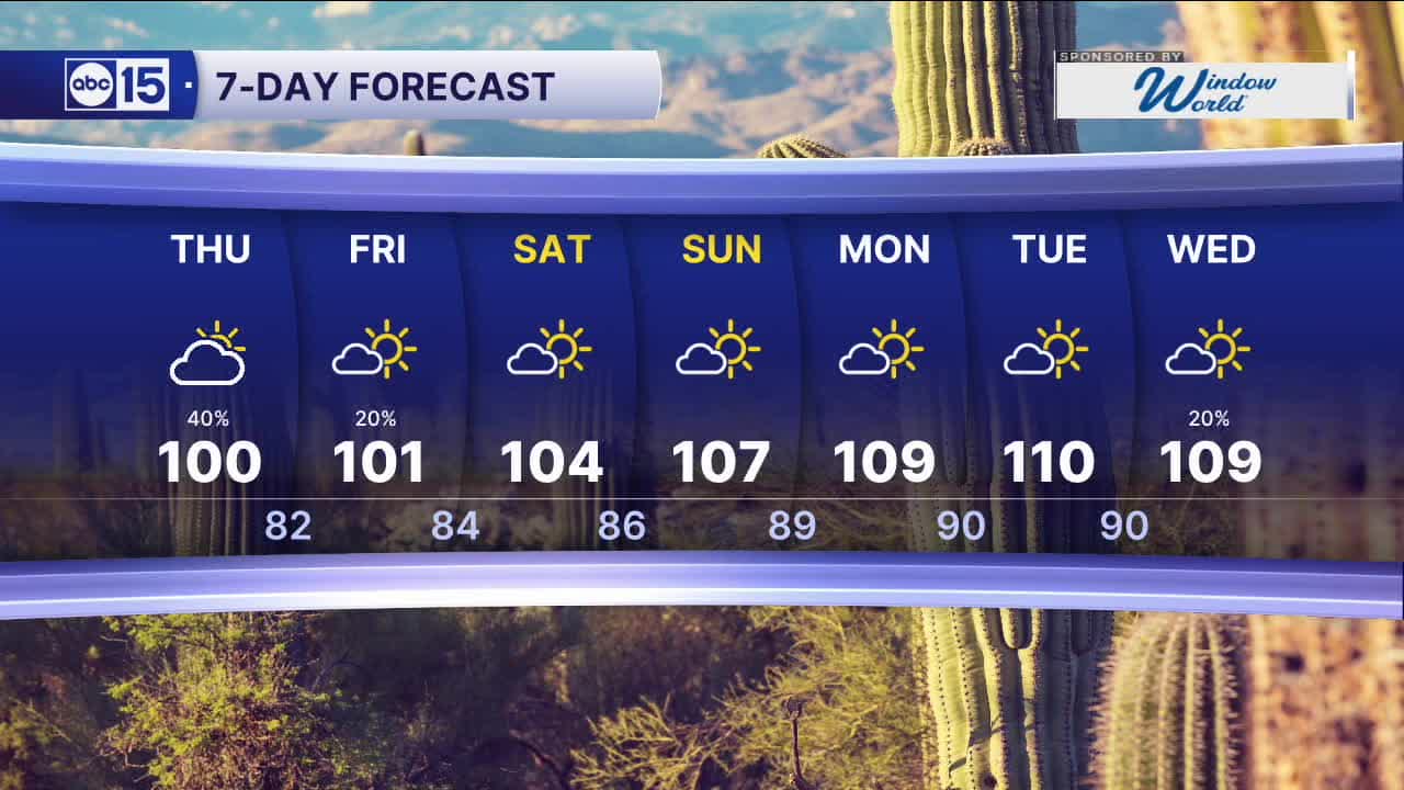
Temperatures will stay a few degrees below normal for the rest of the week, with highs near 100 degrees in the Valley.
As our forecast dries back out over the weekend, temperatures will start to soar.
Phoenix will be back up to near 110 degrees early next week.


2026 Sky Harbor Rainfall to-date: 0.94" (-3.28" from average)
2026 Monsoon Rainfall to-date: 0.62" (-0.68" from average)
__________________________________________
Daily rainfall reports from all across the Valley can be found here.
__________________________________________
PHOENIX IS GETTING DRIER - LOWER RAINFALL AVERAGES NOW
Average Monsoon Rainfall in Phoenix (1981-2010): 2.71" of rain
NEW Average Monsoon Rainfall in Phoenix (1991-2020): 2.43" of rain
Average Yearly Rainfall in Phoenix (1981-2010): 8:03" of rain
NEW Average Yearly Rainfall in Phoenix (1991-2020): 7.22" of rain
__________________________________________
Share your weather photos and videos with us anytime: share@abc15.com.
______________________________________
