

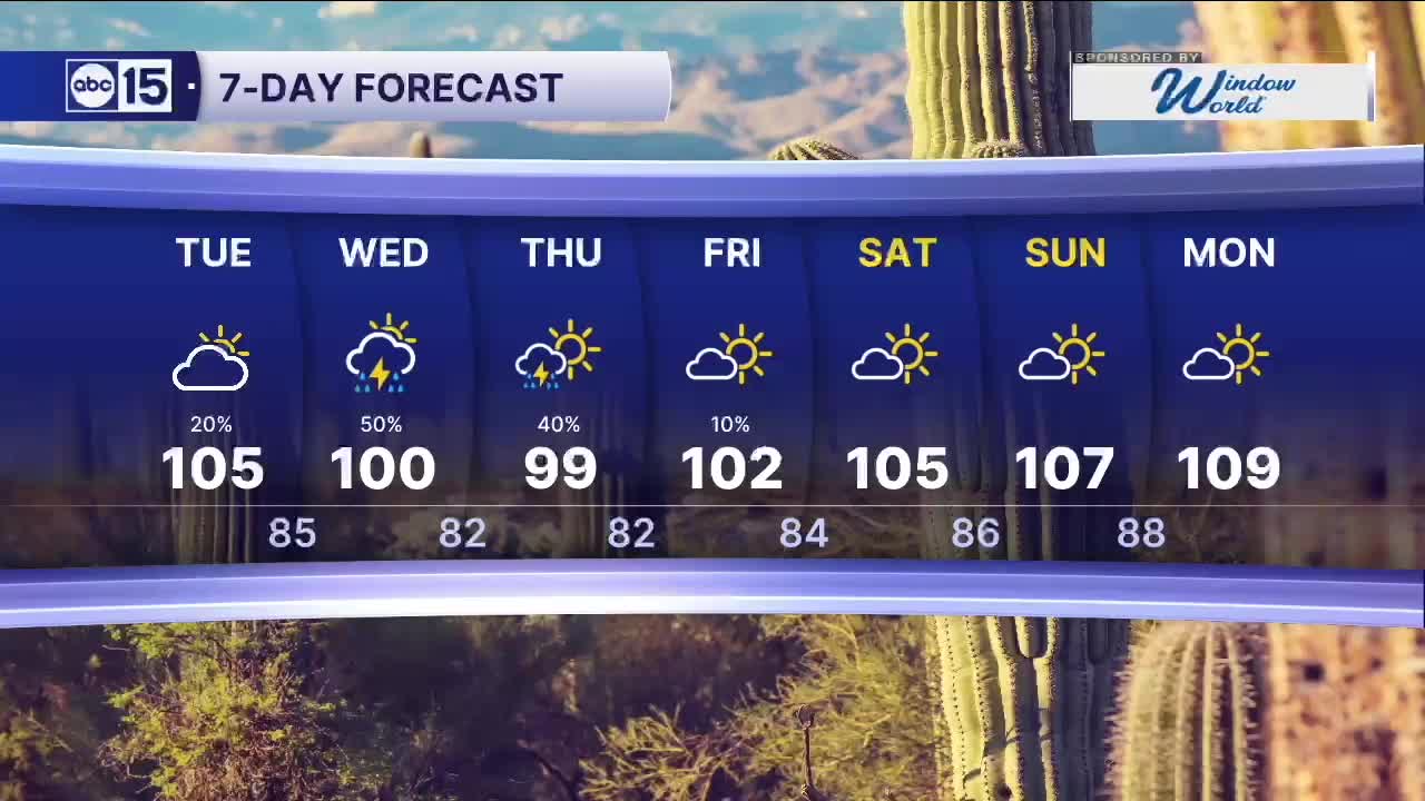


PHOENIX — Monsoon storm chances are ramping up over the next few days!
Sunday night may have been a preview of what's ahead, with strong to severe thunderstorms hitting the Valley. Damaging wind gusts topped 80 mph in some Valley locations as those storms moved through!
Storms will continue to fire up across southeastern Arizona and in the higher terrain first each day this week. Then, there's a chance for those storms to head toward the Valley in the evening and overnight hours.
We could see damaging winds, blowing dust, heavy rain and dangerous lightning, so stay ahead of the storms and check out our free ABC15 mobile app for live interactive radar.
Flooding will also be a concern, especially in southern Arizona, where a Flood Watch is in effect through tonight.
We are also tracking air quality alerts here in the Valley.
Another Ozone High Pollution Advisory has been issued for Tuesday, and an Ozone High Pollution Watch is in effect for Wednesday.
If you have asthma, COPD, or any other respiratory issue, limit your time outside in the afternoon hours or you may have difficulty breathing. Exposure to ozone can increase the number and severity of asthma attacks, cause or aggravate bronchitis or other lung disease, and reduce the body's ability to fight infection.
Kids, older adults and anyone trying to exercise outside may experience health impacts from ozone pollution. Symptoms may include itchy eyes, nose and throat, wheezing, coughing, shortness of breath, chest pain, and upper respiratory issues.
We can all help prevent the pollution problem from getting worse. If you have a gas-powered vehicle, try to drive as little as possible this week. Carpooling, working from home, or re-fueling your vehicle after dark helps too.


2026 Sky Harbor Rainfall to-date: 0.78" (-3.38" from average)
2026 Monsoon Rainfall to-date: 0.46" (-0.78" from average)
__________________________________________
Daily rainfall reports from all across the Valley can be found here.
__________________________________________
PHOENIX IS GETTING DRIER - LOWER RAINFALL AVERAGES NOW
Average Monsoon Rainfall in Phoenix (1981-2010): 2.71" of rain
NEW Average Monsoon Rainfall in Phoenix (1991-2020): 2.43" of rain
Average Yearly Rainfall in Phoenix (1981-2010): 8:03" of rain
NEW Average Yearly Rainfall in Phoenix (1991-2020): 7.22" of rain
__________________________________________
Share your weather photos and videos with us anytime: share@abc15.com.
______________________________________
