

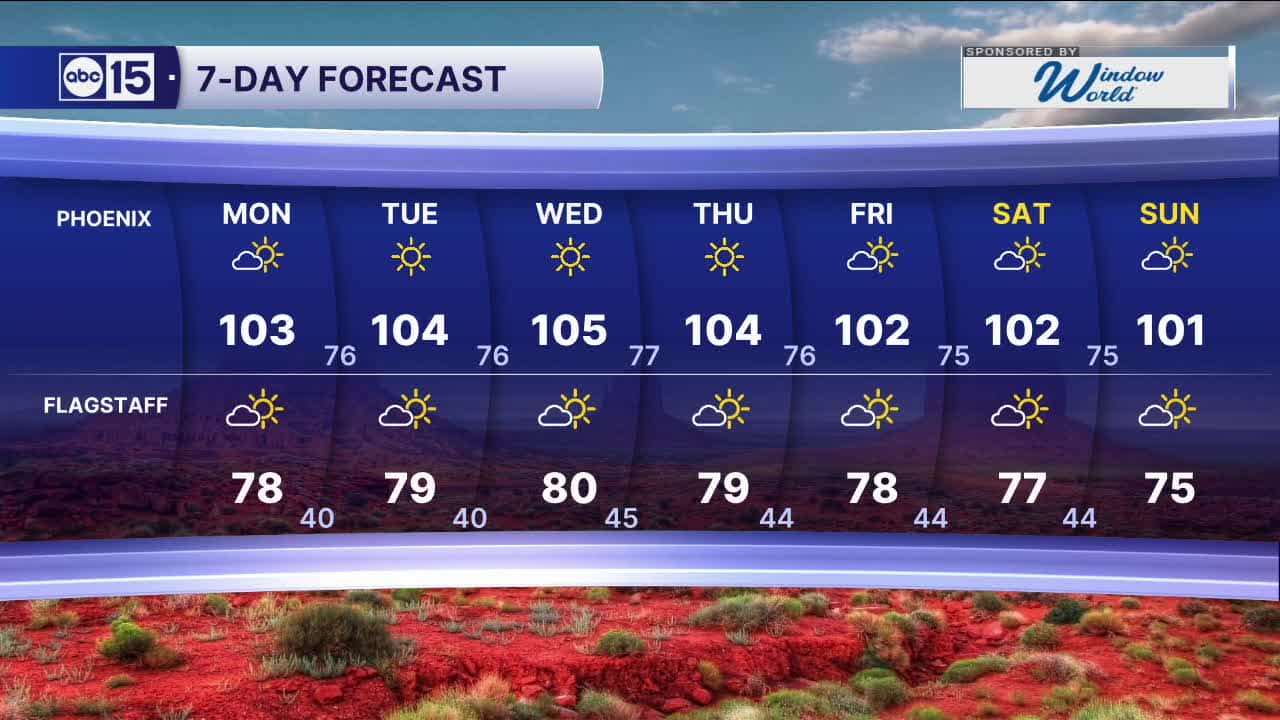


PHOENIX — High pressure is building in and keeping temperatures on the rise over the next few days.
Here in the Valley, we'll heat back into the triple digits starting Monday.
The peak of the heat will be during the middle of next week as Phoenix approaches 105 degrees.
Then, breezes will pick up starting Thursday and temperatures will drop just a bit.
It still looks like we'll hold onto the triple digits for the entire first week of June, but Phoenix will drop closer to the low 100s by Friday.


2026 Sky Harbor Official Rainfall to date: 0.32" (-2.60" from average)
__________________________________________
Daily rainfall reports from all across the Valley can be found here.
__________________________________________
PHOENIX IS GETTING DRIER - LOWER RAINFALL AVERAGES NOW
Average Monsoon Rainfall in Phoenix (1981-2010): 2.71" of rain
NEW Average Monsoon Rainfall in Phoenix (1991-2020): 2.43" of rain
Average Yearly Rainfall in Phoenix (1981-2010): 8:03" of rain
NEW Average Yearly Rainfall in Phoenix (1991-2020): 7.22" of rain
__________________________________________
Share your weather photos and videos with us anytime: share@abc15.com.
______________________________________
