

PHOENIX — It's been a hot week in the Valley!
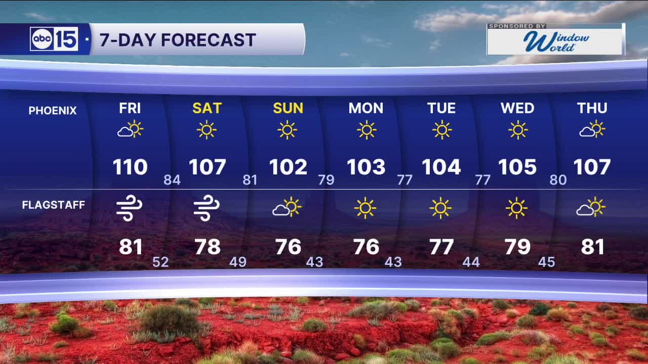
Phoenix has one more day near 110 degrees before temperatures start to drop.
Our Valley forecast is looking mostly dry, but there is still a chance of spotty monsoon storms across central and eastern portions of our state state.
As low pressure passes to our north in the coming days, winds will crank up and fire danger will increase.
Red Flag Warnings and Wind Advisories are in effect Friday through Sunday for parts of northern, central and western Arizona, where wind gusts could exceed 45 mph. More Red Flag Warnings will be added across southeastern Arizona on Saturday and Sunday.
Outdoor burning is highly discouraged. Avoid tossing cigarettes from vehicles and make sure nothing is dragging from your car that could spark a fire.
Those winds will help usher in some cooler air, though.
Valley temperatures are expected to fall into the low 100s by the end of the weekend.


2026 Sky Harbor Official Rainfall to date: 0.32" (-2.61" from average)
Monsoon 2026 Sky Harbor Official Rainfall to date: 0.00" (-0.01" from average)
__________________________________________
Daily rainfall reports from all across the Valley can be found here.
__________________________________________
PHOENIX IS GETTING DRIER - LOWER RAINFALL AVERAGES NOW
Average Monsoon Rainfall in Phoenix (1981-2010): 2.71" of rain
NEW Average Monsoon Rainfall in Phoenix (1991-2020): 2.43" of rain
Average Yearly Rainfall in Phoenix (1981-2010): 8:03" of rain
NEW Average Yearly Rainfall in Phoenix (1991-2020): 7.22" of rain
__________________________________________
Share your weather photos and videos with us anytime: share@abc15.com.
______________________________________
