



PHOENIX — Monsoon 2026 is back in action!
Showers and thunderstorms are moving through parts of our state, bringing heavy downpours and flash flooding.
The National Weather Service has issued a Flood Watch for much of the state, including the Valley, as storms have the potential to drop 2 to 3 inches of rain per hour!
The Flood Watch here in the Phoenix metro area will be in effect until 5 a.m. on Friday.
With the potential for heavy rain and flooding, it's an ABC15 Weather Action Day. Take action to prepare for heavy rain and flooding overnight. If you are in a flood-prone area or located near/downstream of a wildfire burn scar, have sandbags in place.
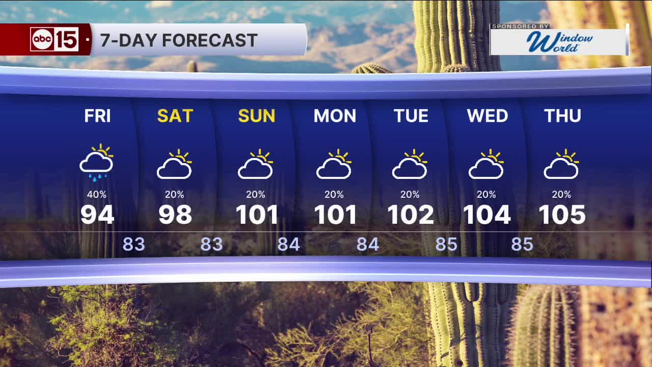
Rain showers could extend into your Friday morning commute, then we'll dry things out a bit here in Phoenix Friday evening.
Temperatures are dropping, too! Expect Valley temperatures to top out in the mid 90s on Friday, which is more than 10 degrees below normal for this time of year.
We'll still be in the 90s on Saturday before the triple digits return heading into next week.
Storm chances will stay in the forecast too, especially for the high country.
Here in the Valley, expect a slight chance of spotty showers and thunderstorms each day through the weekend and early next week.


_________________________________________
2024 Sky Harbor Official Rainfall to date: 4.54" (-1.85" from average)
Monsoon 2024 Sky Harbor Official Rainfall: 0.74" (-1.69" from average)
__________________________________________
Daily rainfall reports from all across the Valley can be found here.
__________________________________________
PHOENIX IS GETTING DRIER - LOWER RAINFALL AVERAGES NOW
Average Monsoon Rainfall in Phoenix (1981-2010): 2.71" of rain
NEW Average Monsoon Rainfall in Phoenix (1991-2020): 2.43" of rain
Average Yearly Rainfall in Phoenix (1981-2010): 8:03" of rain
NEW Average Yearly Rainfall in Phoenix (1991-2020): 7.22" of rain
__________________________________________
Share your weather photos and videos with us anytime: share@abc15.com.
______________________________________
