

PHOENIX — More rain and storms are on the way today!
Moisture from Raymond is keeping our atmosphere full of tropical humidity, setting the stage for more showers and thunderstorms across Arizona.
Due to the threat for flooding and severe weather, Monday is an ABC15 Weather Action Day.
Now’s the time to make sure you’re ready. Give yourself extra time to travel, never drive through flooded roads, and have a plan in case flooding affects your neighborhood.
A Flood Watch remains in effect through this evening for the Valley and southern Arizona. Flash flooding will be a big concern as dry washes could quickly turn into running streams, and water may collect in low-lying areas.
At times, thunderstorms could also bring damaging winds, lightning, small hail, and brief heavy downpours.
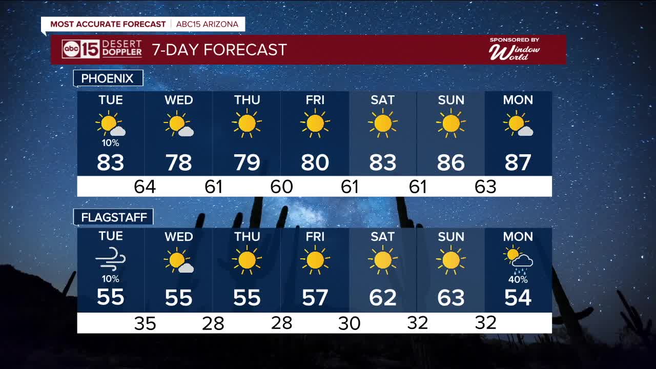
Conditions start to dry out on Tuesday as a Pacific storm moves through, bringing gusty winds and cooler temperatures.
A Wind Advisory is in effect today for Mohave County and expands into other parts of the high country on Tuesday. Gusts up to 45 mph will be possible.
This wetter pattern brings a welcome break from the heat!
Highs stay in the 70s and 80s through the week, with cool mornings in the upper 50s to low 60s.


2025 Sky Harbor Official Rainfall to date: 5.57" (+1.67" from average)
Monsoon 2025 Sky Harbor Official Rainfall: 2.76" (+0.33" from average)
__________________________________________
Daily rainfall reports from all across the Valley can be found here.
__________________________________________
PHOENIX IS GETTING DRIER - LOWER RAINFALL AVERAGES NOW
Average Monsoon Rainfall in Phoenix (1981-2010): 2.71" of rain
NEW Average Monsoon Rainfall in Phoenix (1991-2020): 2.43" of rain
Average Yearly Rainfall in Phoenix (1981-2010): 8:03" of rain
NEW Average Yearly Rainfall in Phoenix (1991-2020): 7.22" of rain
__________________________________________
Share your weather photos and videos with us anytime: share@abc15.com.
______________________________________
