

PHOENIX — High pressure is building in and keeping temperatures on the rise over the next few days.
Here in the Valley, we will see highs run as high as 6-7 degrees above normal.
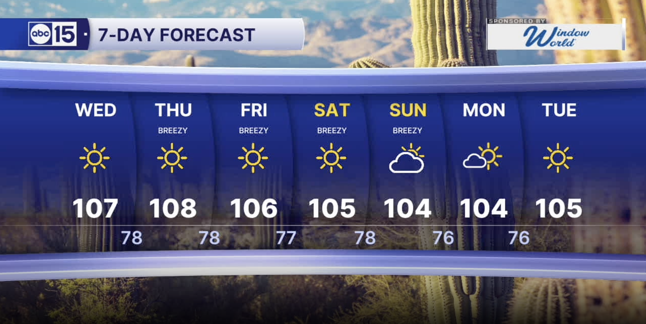
For Wednesday, expect a mostly sunny day with highs topping out around 107 degrees.
The peak of the heat will be tomorrow as Phoenix approaches 108 degrees.
As we head into the midweek, a weak area of low pressure slides to our south, bringing slight storm chances to the White Mountains and far eastern Arizona.
Breezes will also pick up starting Thursday, and temperatures will drop slightly with the passage of this system.
It still looks like we'll hold onto the triple digits for the entire first week of June.
Another storm system set to dive in this weekend, cranking up the winds.
Gusts of 20-30 mph are possible in the Valley and up to 35 mph in the high country.


2026 Sky Harbor Official Rainfall to date: 0.32" (-2.60" from average)
__________________________________________
Daily rainfall reports from all across the Valley can be found here.
__________________________________________
PHOENIX IS GETTING DRIER - LOWER RAINFALL AVERAGES NOW
Average Monsoon Rainfall in Phoenix (1981-2010): 2.71" of rain
NEW Average Monsoon Rainfall in Phoenix (1991-2020): 2.43" of rain
Average Yearly Rainfall in Phoenix (1981-2010): 8:03" of rain
NEW Average Yearly Rainfall in Phoenix (1991-2020): 7.22" of rain
__________________________________________
Share your weather photos and videos with us anytime: share@abc15.com.
______________________________________
