

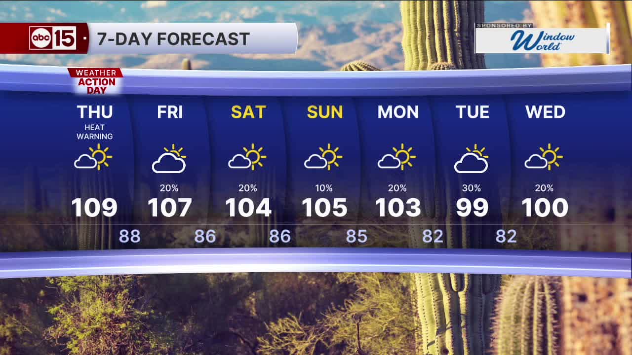


PHOENIX — As high pressure sits overhead, temperatures are heating up this week!
An Extreme Heat Warning remains in effect for the entire Phoenix metro area until 8 p.m. Thursday. Western and southwestern Arizona remain under Extreme Heat Warnings until 8 p.m. Friday.
Wednesday and Thursday are ABC15 Weather Action Days as a reminder to take action to keep you, your loved ones and your pets safe in these dangerously hot temperatures.
Valley high temperatures will flirt with 110 degrees and overnight lows will only drop into the mid to upper 80s each day.
This combination of warm overnights and sizzling hot afternoons will increase the risk for heat-related illnesses. Make sure to limit your time outside in the heat of the day, stay hydrated and never leave kids or pets inside your vehicles.
Monsoon storms will continue to fire up along the Mogollon Rim, in the White Mountains an across southeast Arizona through the end of the week.
While the Valley could see an increase in clouds and a stray shower late Wednesday night, better storm chances return by Friday.
Storm chances will continue through the weekend and early next week, too.
The heat will finally ease across the state by the weekend as we track a disturbance that will pass north of Arizona, dropping temperatures closer to the averages for this time of year.
Valley highs could fall into the low 100s by early next week.


2026 Sky Harbor Rainfall to-date: 1.73" (-3.26" from average)
2026 Monsoon Rainfall to-date: 1.41" (-0.64" from average)
_________________________________________
Daily rainfall reports from all across the Valley can be found here.
__________________________________________
PHOENIX IS GETTING DRIER - LOWER RAINFALL AVERAGES NOW
Average Monsoon Rainfall in Phoenix (1981-2010): 2.71" of rain
NEW Average Monsoon Rainfall in Phoenix (1991-2020): 2.43" of rain
Average Yearly Rainfall in Phoenix (1981-2010): 8:03" of rain
NEW Average Yearly Rainfall in Phoenix (1991-2020): 7.22" of rain
__________________________________________
Share your weather photos and videos with us anytime: share@abc15.com.
______________________________________
