

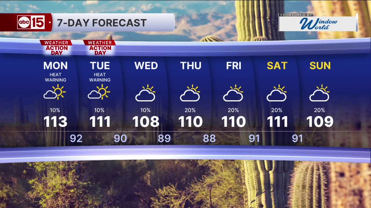


PHOENIX — A couple more record broken to wrap up the weekend. Phoenix recorded a record warm morning low and a record high in the afternoon of 115 degrees breaking last years record of 114.
Our Extreme Heat Warning has been extended and is now in effect through Tuesday. For Mohave County it will remain in place through Wednesday.
A Heat Advisory is also in place for northeastern Arizona through Monday.
Temperatures in the Valley are set to climb to nearly 113 degrees Monday, with little overnight relief as lows only fall into the mid-90s.
So, our ABC15 Weather Action Days continue through Tuesday as a reminder to take action to stay safe in this dangerous heat. Limit your time outside and drink plenty of water throughout the day. Bring your pets inside too, and never leave kids or pets in the car.
Heat like this is becoming more common as our climate changes, and one of the biggest drivers here in the Valley is the rapid growth of our urban heat island.
Chief Meteorologist Amber Sullins spoke with researchers at ASU who have identified another reason why overnight temperatures in Phoenix keep getting hotter year after year. They have found that heat is being transported overnight from the west and northwest Valley into Phoenix.
Watch the full interview here:
Monsoon moisture will increase heading into next week as high pressure shifts farther north and east. That will bring a slight chance of storms back to the Valley and begin to pull temperatures back. However, highs still are shaping up to be running above normal.


2026 Sky Harbor Rainfall to-date: 0.78" (-3.10" from average)
2026 Monsoon Rainfall to-date: 0.46" (-0.47" from average)
__________________________________________
Daily rainfall reports from all across the Valley can be found here.
__________________________________________
PHOENIX IS GETTING DRIER - LOWER RAINFALL AVERAGES NOW
Average Monsoon Rainfall in Phoenix (1981-2010): 2.71" of rain
NEW Average Monsoon Rainfall in Phoenix (1991-2020): 2.43" of rain
Average Yearly Rainfall in Phoenix (1981-2010): 8:03" of rain
NEW Average Yearly Rainfall in Phoenix (1991-2020): 7.22" of rain
__________________________________________
Share your weather photos and videos with us anytime: share@abc15.com.
______________________________________
