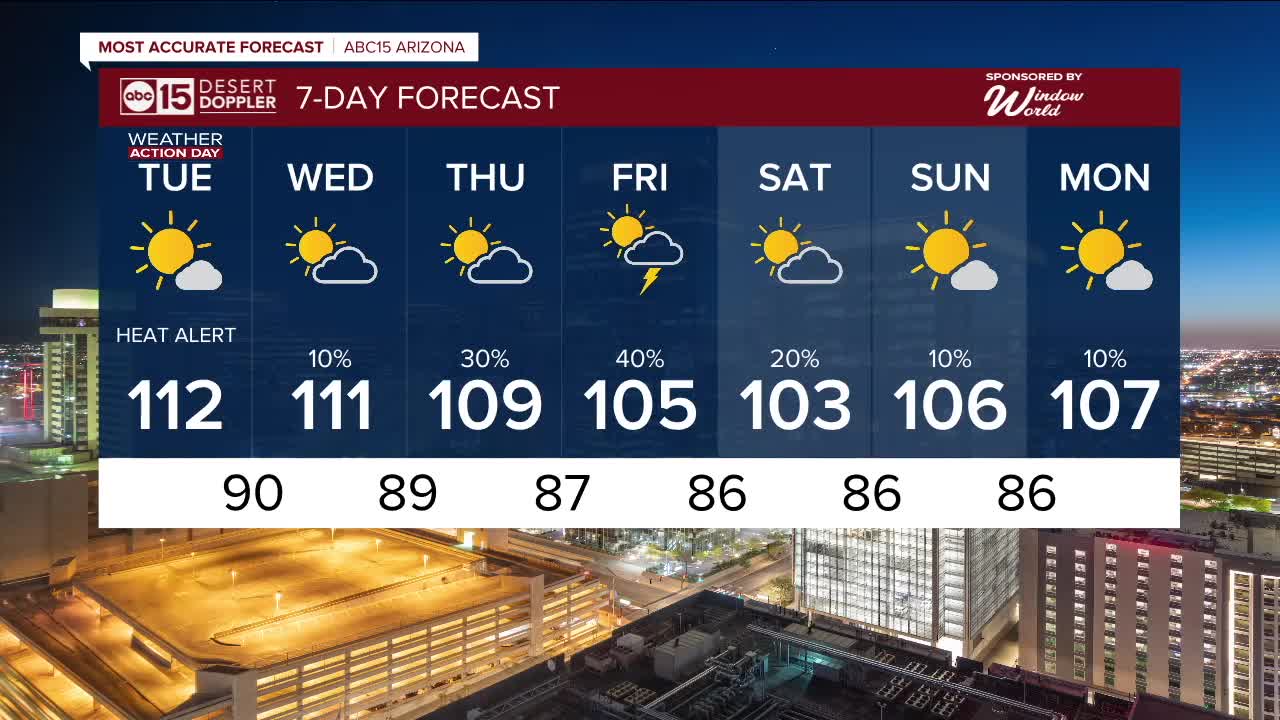


PHOENIX — Extreme heat continues to grip the Valley!
An Extreme Heat Warning remains in effect for central and western Arizona through Tuesday evening and for the Grand Canyon below 4,000 feet through Thursday evening.
A Heat Advisory is also in place for the Northwest Plateau of Mohave County through Tuesday.
With the extreme heat in place, we remain in ABC15 Weather Action Mode through Tuesday as a reminder to take action to protect yourself, your loved ones and your pets.
Avoid contact with hot surfaces such as car doors, steering wheels, and playground equipment, as they can cause serious burns within seconds.
Monsoon moisture will bring showers and thunderstorms to parts of the high country this week, and by Wednesday we'll start to see chances for storms here in the Valley too.
The best chances for Valley storms will be Thursday and Friday. Stay tuned for updates as we get closer.


2025 Sky Harbor Official Rainfall to date: 1.63" (-2.56" from average)
Monsoon 2025 Sky Harbor Official Rainfall: 0.16" (-1.08" from average)
__________________________________________
Daily rainfall reports from all across the Valley can be found here.
__________________________________________
PHOENIX IS GETTING DRIER - LOWER RAINFALL AVERAGES NOW
Average Monsoon Rainfall in Phoenix (1981-2010): 2.71" of rain
NEW Average Monsoon Rainfall in Phoenix (1991-2020): 2.43" of rain
Average Yearly Rainfall in Phoenix (1981-2010): 8:03" of rain
NEW Average Yearly Rainfall in Phoenix (1991-2020): 7.22" of rain
__________________________________________
Share your weather photos and videos with us anytime: share@abc15.com.
______________________________________
