

PHOENIX — After a very soggy weekend, we are finally drying things out.
Last weeks storms brought our November monthly rain total at Sky Harbor Airport to 0.79 inches. That is well above our monthly average of 0.57 inches.
All of that rain is also making Fall 2025 (Sept. - Nov.) as the wettest on record with 6.31inches. The previous record was 6.18 inches of rain in 1939.
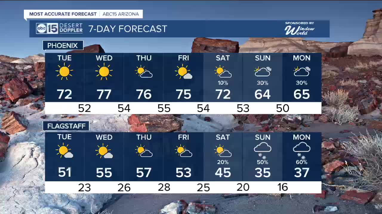
A warm-up is on the way as high pressure moves in and takes control of our weather pattern this week.
With dry northwest winds and clear skies our afternoon temperatures will warm up a few degrees each afternoon this week. With highs in the mid to upper 70s by Wednesday.
For Thanksgiving it will be a chilly start to the day with lows in the mid-50s. partly cloudy skies by a dry and warm afternoon in the upper 70s.
The Territorial Cup forecast looks fantastic with clearing skies and temperatures in the low 70s by kickoff.
Later this weekend, temperatures will dip again as another storm system approaches, bringing a return of rain and snow chances across the state.
As of right now, models are not in great agreement as to how much rain and snow we will get.
Stay tuned for more updates as the storm gets closer.


2025 Sky Harbor Official Rainfall to date: 8.28" (+1.94" from average)
Monsoon 2025 Sky Harbor Official Rainfall: 2.76" (+0.33" from average)
__________________________________________
Daily rainfall reports from all across the Valley can be found here.
__________________________________________
PHOENIX IS GETTING DRIER - LOWER RAINFALL AVERAGES NOW
Average Monsoon Rainfall in Phoenix (1981-2010): 2.71" of rain
NEW Average Monsoon Rainfall in Phoenix (1991-2020): 2.43" of rain
Average Yearly Rainfall in Phoenix (1981-2010): 8:03" of rain
NEW Average Yearly Rainfall in Phoenix (1991-2020): 7.22" of rain
__________________________________________
Share your weather photos and videos with us anytime: share@abc15.com.
______________________________________
