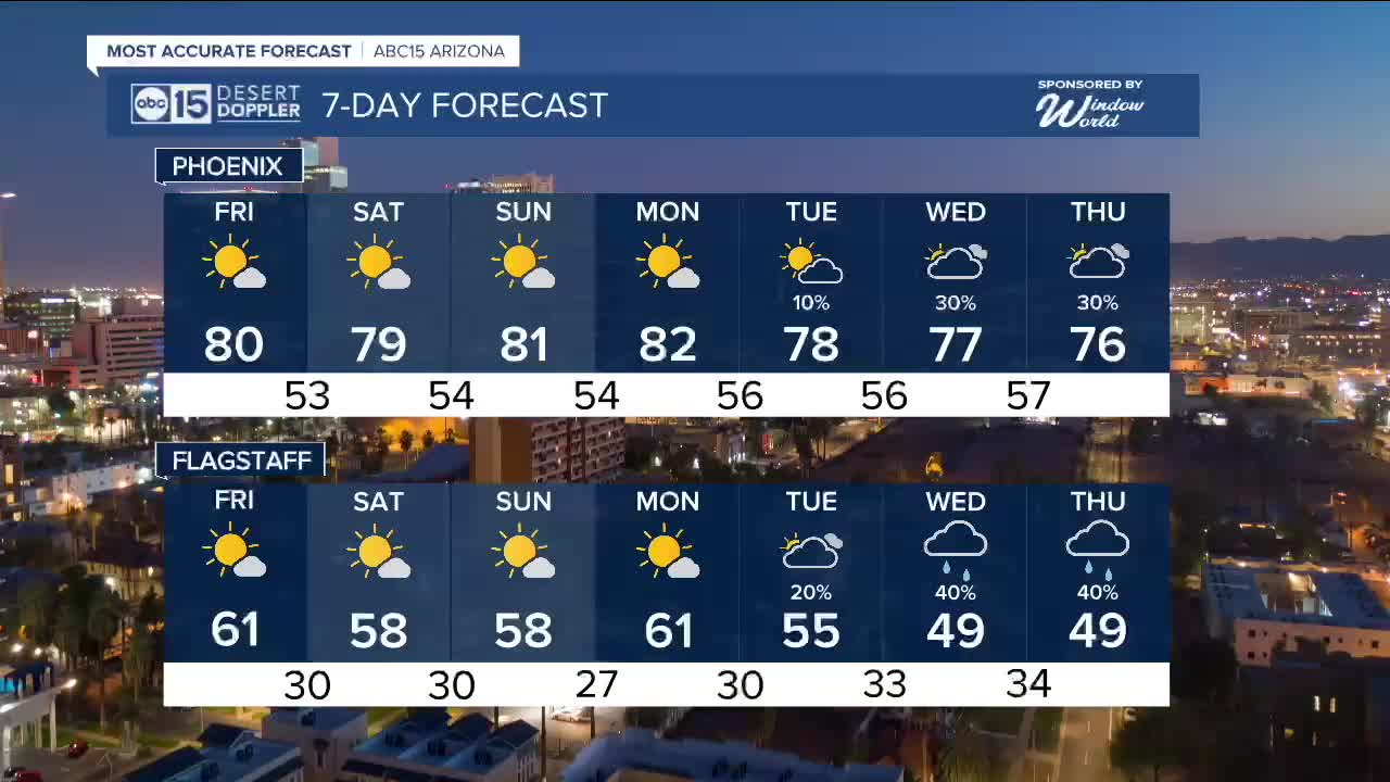


PHOENIX — High pressure is keeping Arizona incredibly warm this December!
Phoenix set back-to-back records on Sunday and Monday with highs in the low 80s, and now more record-breaking 80s are in the forecast as we inch closer to Christmas.
The record is 7 days in the 80s in December of 1980, but 2025 could end up in second or third place for the most December days in the 80s in Phoenix.
Average high temperatures for this time of year are in the mid-60s, so we're running around 15 degrees above normal!
With Valley highs in the 70s again on Thursday, our daily heat record of 83 degrees is safe. But, more daily heat records are in jeopardy Sunday and Monday in Phoenix as temperatures soar back into the low 80s.
We are also tracking a nice shift in the forecast by Christmas Eve and Christmas Day as temperatures start to drop and chances for rain return to Arizona. Stay tuned for updates as we get closer!


2025 Sky Harbor Official Rainfall to date: 8.28" (+1.38" from average)
Monsoon 2025 Sky Harbor Official Rainfall: 2.76" (+0.33" from average)
__________________________________________
Daily rainfall reports from all across the Valley can be found here.
__________________________________________
PHOENIX IS GETTING DRIER - LOWER RAINFALL AVERAGES NOW
Average Monsoon Rainfall in Phoenix (1981-2010): 2.71" of rain
NEW Average Monsoon Rainfall in Phoenix (1991-2020): 2.43" of rain
Average Yearly Rainfall in Phoenix (1981-2010): 8:03" of rain
NEW Average Yearly Rainfall in Phoenix (1991-2020): 7.22" of rain
__________________________________________
Share your weather photos and videos with us anytime: share@abc15.com.
______________________________________
