

PHOENIX — After a record-breaking start to March, temperatures are finally starting to drop a bit.
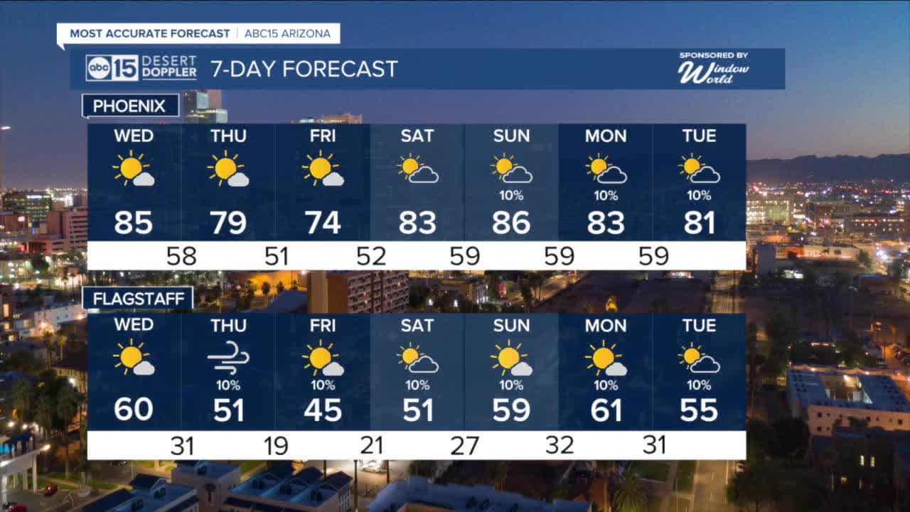
Valley highs are falling into the 80s through Wednesday before falling even more as our next storm system moves in by the end of the week.
Winds will pick up on Thursday and we could even see a few isolated rain and snow showers across northern Arizona as that next storm arrives.
Right now, our Valley forecast looks dry but wind gusts could top 25 mph and temperatures will drop into the 70s on Thursday and Friday.
Up north, peak wind gusts could exceed 40 mph on Thursday.
That storm system will backtrack and hover off the coast of Baja California through the weekend, pumping moisture up into parts of Arizona.
By Sunday and Monday, we might even see a few spotty showers in the Valley. We'll keep you posted as we get closer.


2026 Sky Harbor Official Rainfall to date: 0.26" (-1.59" from average)
_________________________________________
2025 Sky Harbor Official Rainfall: 8.31" (+1.09" from average)
Monsoon 2025 Sky Harbor Official Rainfall: 2.76" (+0.33" from average)
__________________________________________
Daily rainfall reports from all across the Valley can be found here.
__________________________________________
PHOENIX IS GETTING DRIER - LOWER RAINFALL AVERAGES NOW
Average Monsoon Rainfall in Phoenix (1981-2010): 2.71" of rain
NEW Average Monsoon Rainfall in Phoenix (1991-2020): 2.43" of rain
Average Yearly Rainfall in Phoenix (1981-2010): 8:03" of rain
NEW Average Yearly Rainfall in Phoenix (1991-2020): 7.22" of rain
__________________________________________
Share your weather photos and videos with us anytime: share@abc15.com.
______________________________________
