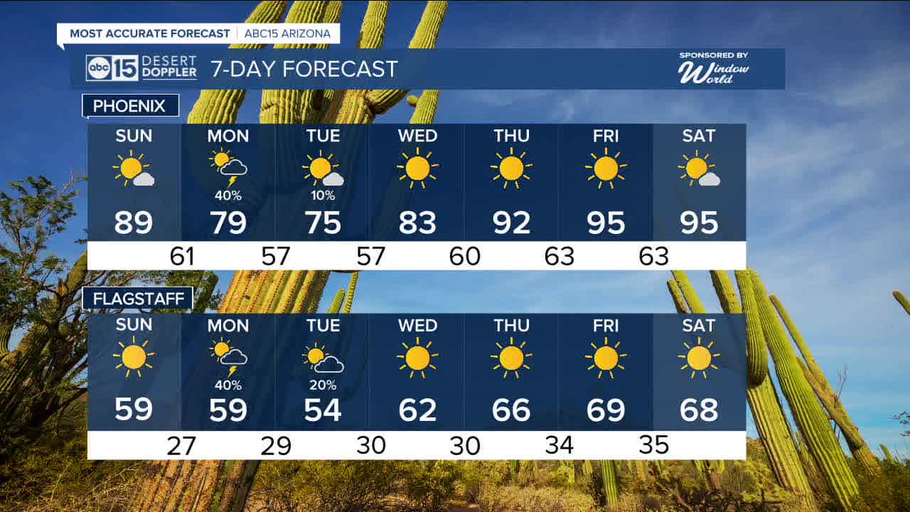


PHOENIX — We are tracking a storm system near Baja California that is set to bring a brief round of cooler air and even a chance for scattered storms.
Before it arrives, we are expecting a very warm and breezy Sunday. Morning temperatures will start in the mid to upper 50s and warm to nearly 90 degrees by the afternoon with sunny skies.
That storm system will move toward Arizona on Monday. While current data show we should stay dry in the morning, storms look to develop late in the afternoon and continue through the evening.
Rainfall totals in the Valley will likely top out around 0.25 inches, with some isolated higher totals possible in heavier downpours.
As the storm pulls away Tuesday, we will still have a slight chance for a light shower, but high pressure will quickly build in behind the system.
That ridge of high pressure is expected to strengthen and send temperatures in the Valley into the mid-90s. We could even challenge record highs by the end of the week and into next weekend.


2026 Sky Harbor Official Rainfall to date: 0.26" (-1.72" from average)
_________________________________________
2025 Sky Harbor Official Rainfall: 8.31" (+1.09" from average)
Monsoon 2025 Sky Harbor Official Rainfall: 2.76" (+0.33" from average)
__________________________________________
Daily rainfall reports from all across the Valley can be found here.
__________________________________________
PHOENIX IS GETTING DRIER - LOWER RAINFALL AVERAGES NOW
Average Monsoon Rainfall in Phoenix (1981-2010): 2.71" of rain
NEW Average Monsoon Rainfall in Phoenix (1991-2020): 2.43" of rain
Average Yearly Rainfall in Phoenix (1981-2010): 8:03" of rain
NEW Average Yearly Rainfall in Phoenix (1991-2020): 7.22" of rain
__________________________________________
Share your weather photos and videos with us anytime: share@abc15.com.
______________________________________
