

PHOENIX — It's been a cool and breezy start to the week in the Valley!
Valley highs topped out in the low 80s on Monday, putting us a few degrees below normal for this time of year.
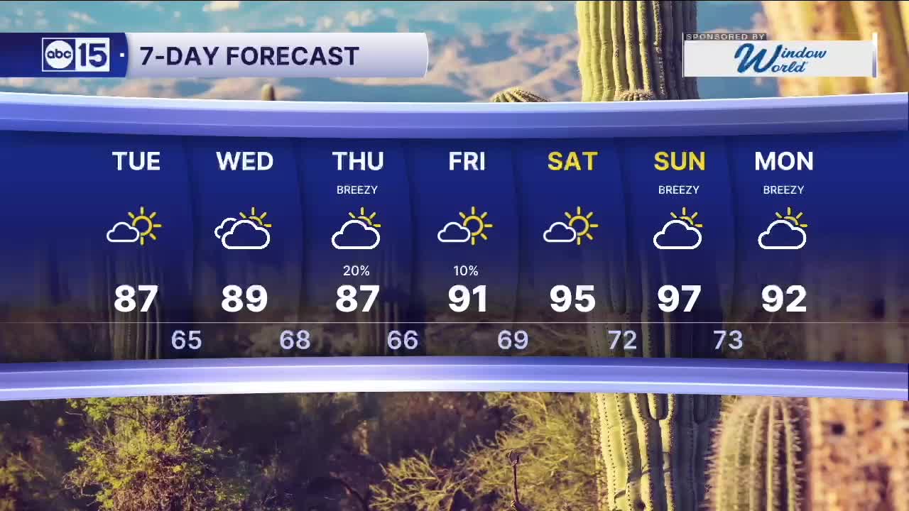
Tuesday and Wednesday will be a bit warmer with highs in the upper 80s across the Phoenix metro area.
We are also tracking a storm system moving in later this week, bringing rain chances to parts of central and southern Arizona.
Here in the Valley, we could see a few spotty showers Thursday and Friday with less than a tenth of an inch of rain likely.
Parts of southern Arizona could pick up around a quarter of an inch of rain.
The heat returns next weekend as our forecast dries out and Valley temperatures soar into the 90s.


2026 Sky Harbor Official Rainfall to date: 0.32" (-2.46" from average)
__________________________________________
Daily rainfall reports from all across the Valley can be found here.
__________________________________________
PHOENIX IS GETTING DRIER - LOWER RAINFALL AVERAGES NOW
Average Monsoon Rainfall in Phoenix (1981-2010): 2.71" of rain
NEW Average Monsoon Rainfall in Phoenix (1991-2020): 2.43" of rain
Average Yearly Rainfall in Phoenix (1981-2010): 8:03" of rain
NEW Average Yearly Rainfall in Phoenix (1991-2020): 7.22" of rain
__________________________________________
Share your weather photos and videos with us anytime: share@abc15.com.
______________________________________
