

PHOENIX — We're tracking a storm system moving in, bringing more storm chances to parts of our state and cooler air for us all.
Isolated showers and thunderstorms will continue to impact parts of eastern and southeastern Arizona through Saturday night.
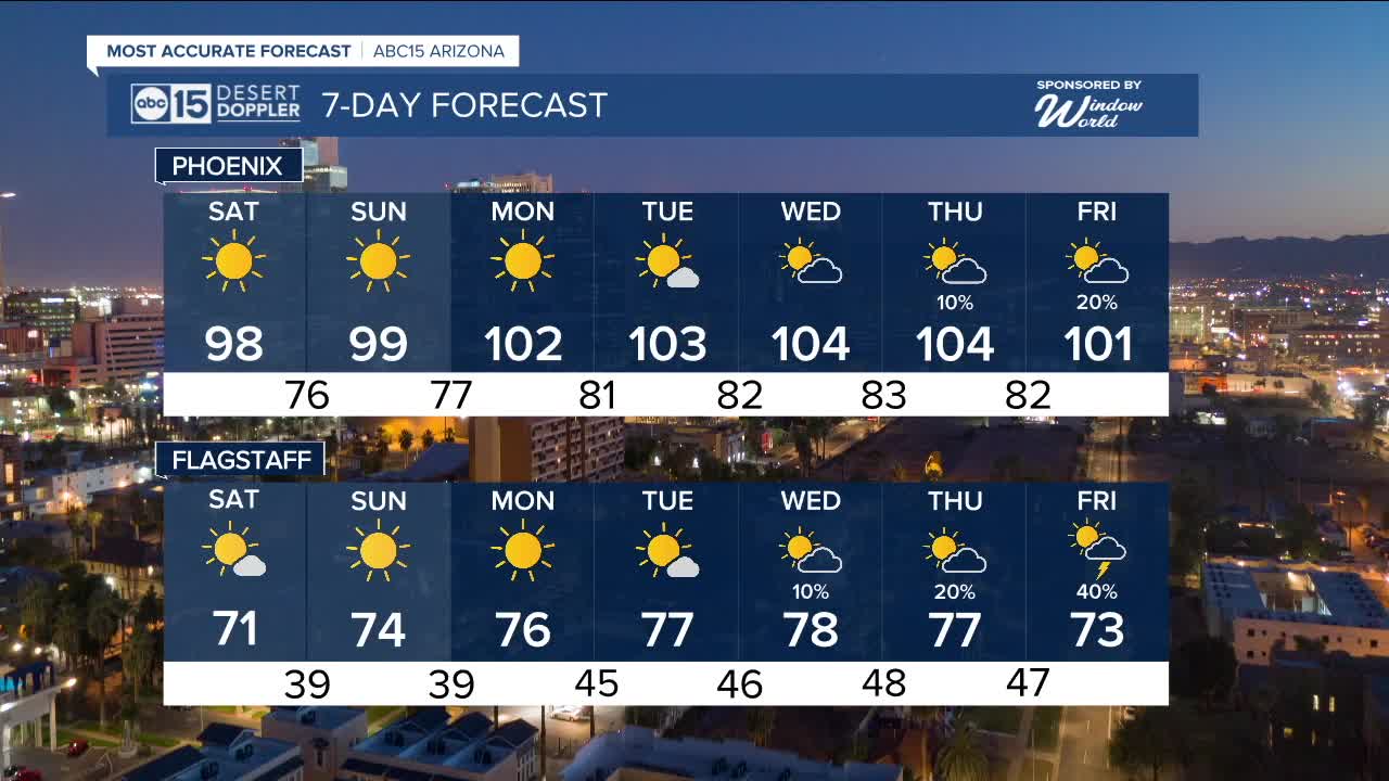
Here in the Valley, our weekend forecast will stay dry, but temperatures will drop into the upper 90s.
Overnight lows will also get cooler, dropping into the 70s Valley-wide.
As high pressure returns next week, we'll climb back into the triple digits starting Monday.
Monsoon moisture will start to flow back in next week and could be enhanced by remnant moisture from Tropical Storm Mario.
That could really increase storm chances across Arizona toward the end of next week as another storm system moves in from the northwest at the same time.
We're closely monitoring this complex set-up and how it could impact the Valley. We will have updates for you as we get closer.


2025 Sky Harbor Official Rainfall to date: 2.15" (-2.90" from average)
Monsoon 2025 Sky Harbor Official Rainfall: 0.68" (-1.43" from average)
__________________________________________
Daily rainfall reports from all across the Valley can be found here.
__________________________________________
PHOENIX IS GETTING DRIER - LOWER RAINFALL AVERAGES NOW
Average Monsoon Rainfall in Phoenix (1981-2010): 2.71" of rain
NEW Average Monsoon Rainfall in Phoenix (1991-2020): 2.43" of rain
Average Yearly Rainfall in Phoenix (1981-2010): 8:03" of rain
NEW Average Yearly Rainfall in Phoenix (1991-2020): 7.22" of rain
__________________________________________
Share your weather photos and videos with us anytime: share@abc15.com.
______________________________________
