



PHOENIX — Warm, windy and dry weather will continue into the new week as high pressure remains in control.
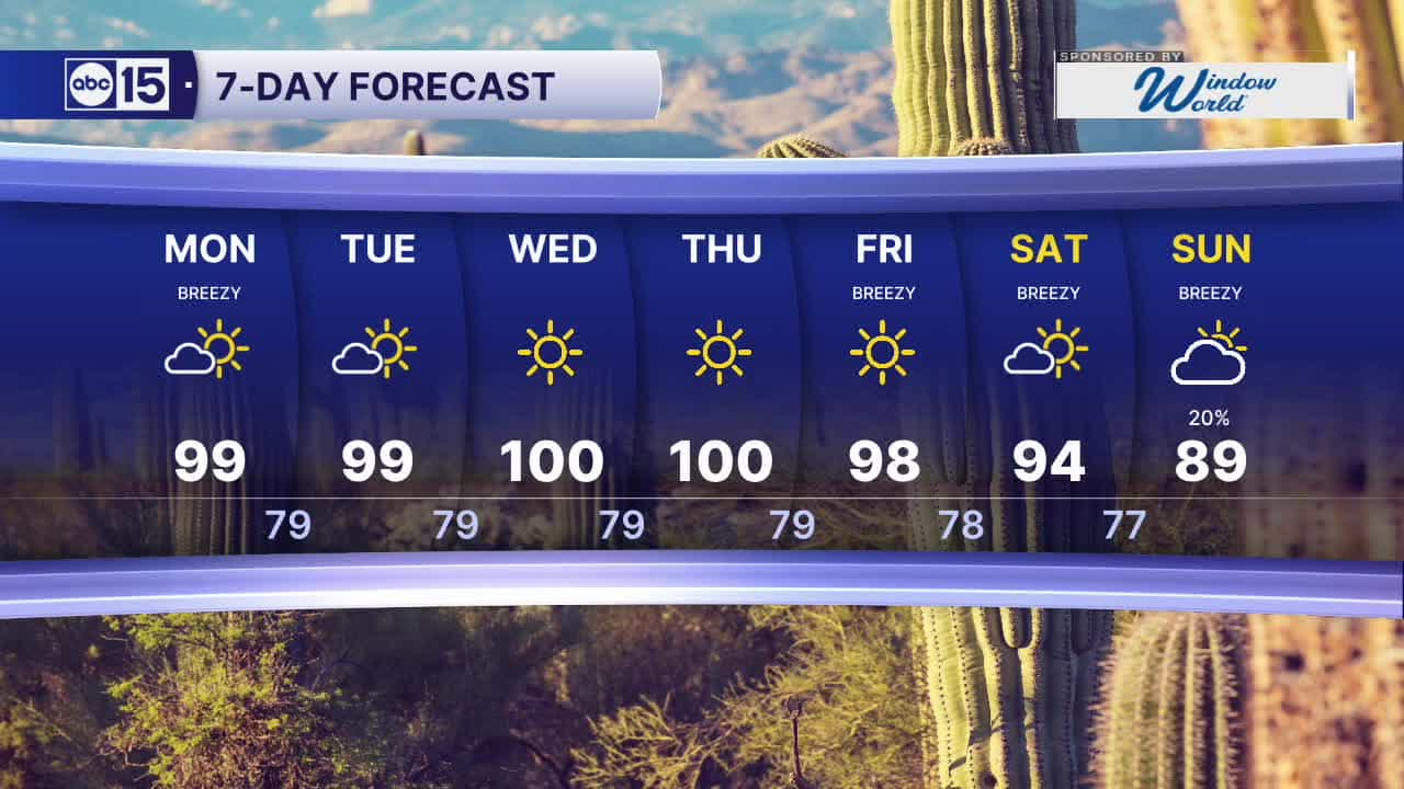
Look for Valley highs in the upper 90s and low 100s each day this week, with Wednesday and Thursday the hottest days.
On average, Phoenix sees its last 100-degree day in early October, but there are some years the triple digit heat hangs on until just days before Halloween.
Overnight lows will remain unseasonably warm too, only cooling into the upper 70s to low 80s each day.
Breezes will stick around through early this afternoon with peak Valley wind gusts near 30 mph. A few lighter gusts are possible again Tuesday morning, mainly east of the Valley.
Dry weather will continue across Arizona through the early part of the weekend.
We're also tracking Hurricane Rachel in the Eastern Pacific. Its remnant moisture could bring rain chances to Arizona late this weekend into early next week.
Stay tuned for further updates.


2026 Yearly Sky Harbor Rainfall to-date: 2.78" (-2.66" from average)
2026 Monsoon Rainfall: 2.46" (+0.03" from average)
__________________________________________
Daily rainfall reports from all across the Valley can be found here.
__________________________________________
PHOENIX IS GETTING DRIER - LOWER RAINFALL AVERAGES NOW
Average Monsoon Rainfall in Phoenix (1981-2010): 2.71" of rain
NEW Average Monsoon Rainfall in Phoenix (1991-2020): 2.43" of rain
Average Yearly Rainfall in Phoenix (1981-2010): 8:03" of rain
NEW Average Yearly Rainfall in Phoenix (1991-2020): 7.22" of rain
__________________________________________
Share your weather photos and videos with us anytime: share@abc15.com.
______________________________________
