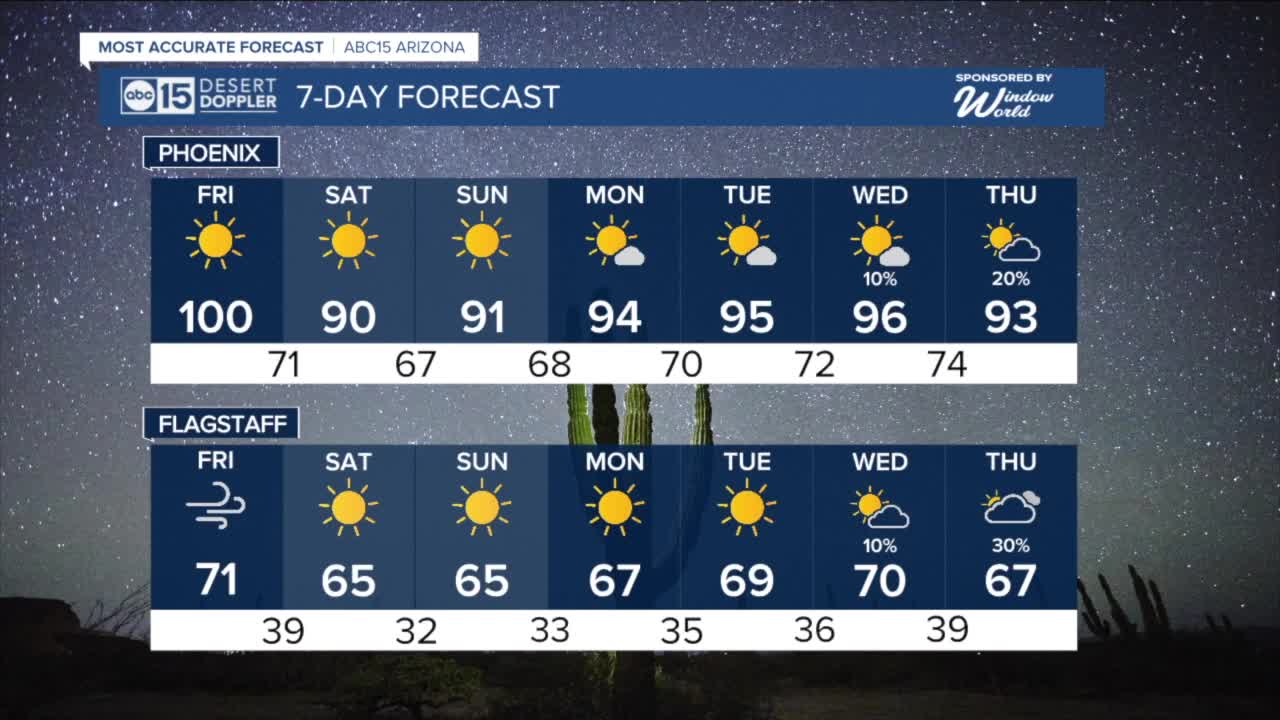


PHOENIX — High pressure has been cranking up the heat across Arizona this week, but we are just days away from a major cool-down.
After topping out in the low 100s Thursday and Friday, the Valley will drop into the upper 80s to low 90s over the weekend!
Before that happens, winds will crank up as a storm system passes to our north.
Wind Advisories are in effect from 11 a.m. until 7 p.m. on Friday across much of the Arizona high country. South to southwest winds at 20 to 30 mph with gusts up to 45 mph are expected in places like Flagstaff, Williams, Munds Park, the Grand Canyon, Snowflake, Winslow, Holbrook and Tuba City.
Here in the Valley, gusts could approach 30 mph Friday afternoon.
Those winds will usher in cooler air, dropping temperatures 8 to 12 degrees across Arizona by Saturday.
Temperatures will start to climb again early next week with Valley highs in the mid 90s on Monday, Tuesday and Wednesday.
By late Wednesday and Thursday, rain chances will be back in the forecast as we track remnant tropical moisture moving in from a storm soon to be named Priscilla.
Stay with ABC15 for the latest updates as we get closer.


2025 Sky Harbor Official Rainfall to date: 4.23" (-1.16" from average)
Monsoon 2025 Sky Harbor Official Rainfall: 2.76" (+0.33" from average)
__________________________________________
Daily rainfall reports from all across the Valley can be found here.
__________________________________________
PHOENIX IS GETTING DRIER - LOWER RAINFALL AVERAGES NOW
Average Monsoon Rainfall in Phoenix (1981-2010): 2.71" of rain
NEW Average Monsoon Rainfall in Phoenix (1991-2020): 2.43" of rain
Average Yearly Rainfall in Phoenix (1981-2010): 8:03" of rain
NEW Average Yearly Rainfall in Phoenix (1991-2020): 7.22" of rain
__________________________________________
Share your weather photos and videos with us anytime: share@abc15.com.
______________________________________
