

PHOENIX — It's a warm start to the week in the Valley!
With high pressure in control, temperatures are running several degrees above normal as our forecast stays sunny and dry.
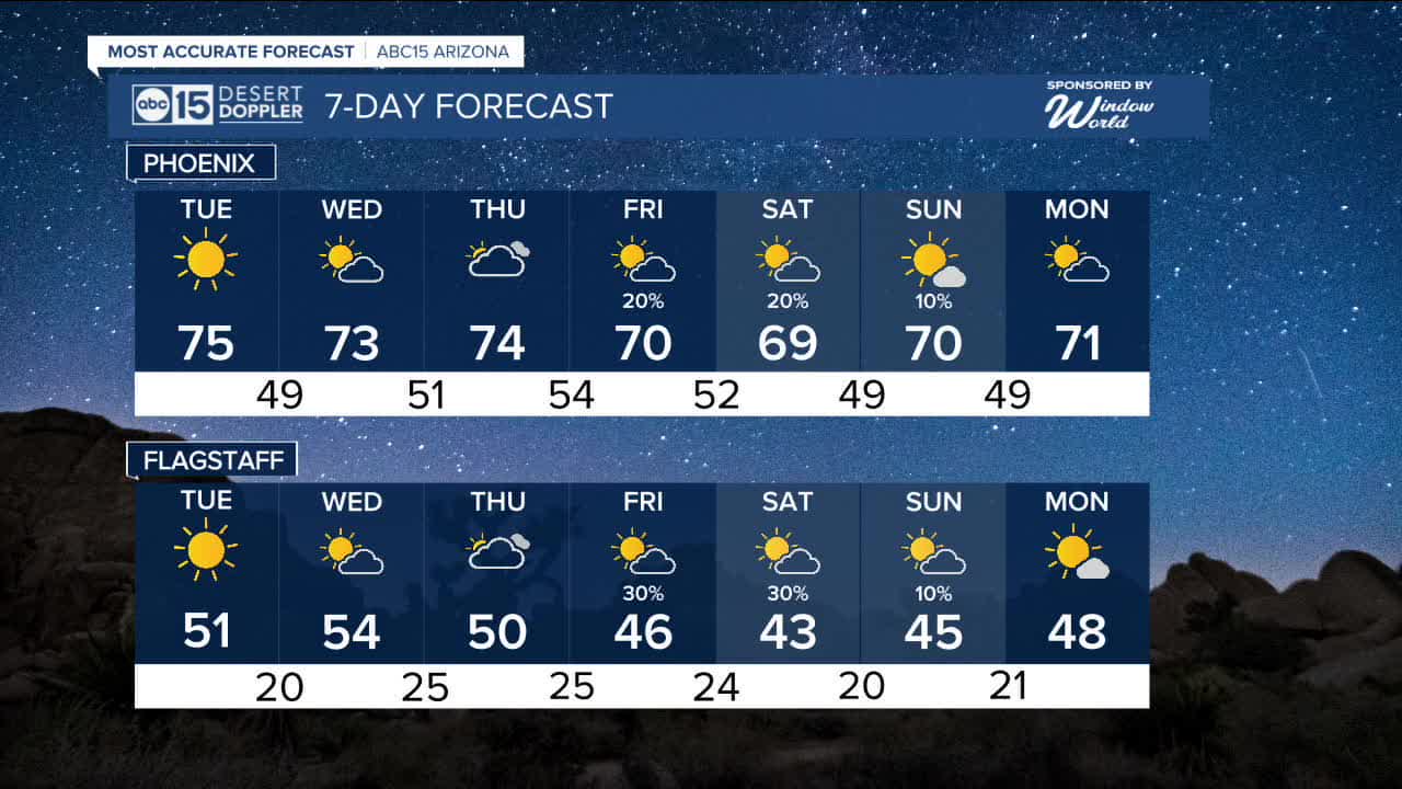
Valley temperatures will top out in the mid 70s through Thursday, with overnight lows in the 40s.
Clouds will start moving in on Wednesday and Thursday ahead of the next storm system we are tracking.
That storm will bring rain chances back to Arizona on Friday, Saturday and Sunday.
We may even see some accumulating snow across parts of the high country over 6,000 feet in elevation.
It's still too soon to know how much rain and snow we could get, but we'll keep you posted as we get closer.
Temperatures will drop, too.
Valley highs will fall into the 60s on Saturday, which is finally near normal for this time of year!


2026 Sky Harbor Official Rainfall to date: 0.18" (-0.39" from average)
_________________________________________
2025 Sky Harbor Official Rainfall: 8.31" (+1.09" from average)
Monsoon 2025 Sky Harbor Official Rainfall: 2.76" (+0.33" from average)
_________________________________________
Daily rainfall reports from all across the Valley can be found here.
__________________________________________
PHOENIX IS GETTING DRIER - LOWER RAINFALL AVERAGES NOW
Average Monsoon Rainfall in Phoenix (1981-2010): 2.71" of rain
NEW Average Monsoon Rainfall in Phoenix (1991-2020): 2.43" of rain
Average Yearly Rainfall in Phoenix (1981-2010): 8:03" of rain
NEW Average Yearly Rainfall in Phoenix (1991-2020): 7.22" of rain
__________________________________________
Share your weather photos and videos with us anytime: share@abc15.com.
______________________________________
