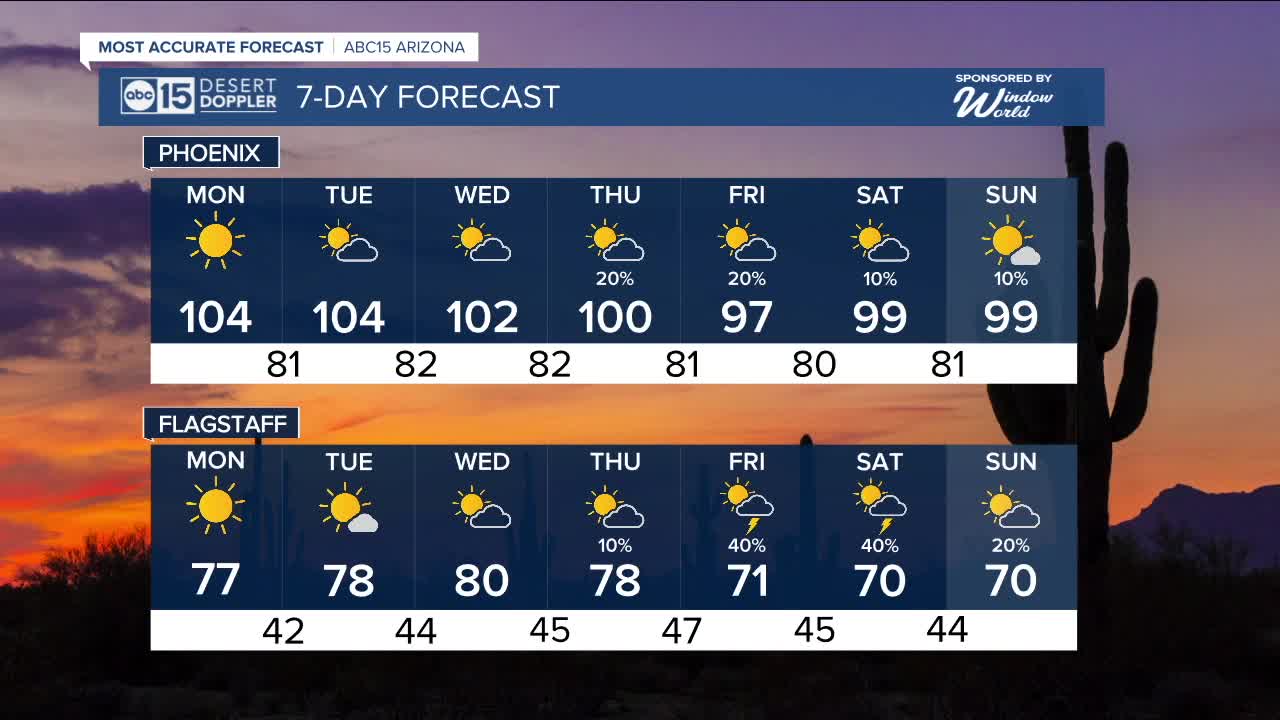


PHOENIX — A storm system that passed to the north brought a beautiful weekend across Arizona. Now, that system is moving out, and a ridge of subtropical high pressure is building in—setting the stage for hotter temperatures to start the week.
Expect mostly sunny skies with afternoon highs in the Valley ranging from 100 to 104 degrees through Tuesday. Morning lows will sit in the upper 70s to lower 80s.
After the midweek, storm chances begin to increase as the ridge potentially pulls in leftover moisture from Tropical Storm Mario, currently in the Pacific. At the same time, a trough of low pressure will try to dip along the West Coast, helping draw that moisture northward.
While there's still considerable uncertainty about how much moisture will reach the state, models suggest that if it does move far enough north, it could significantly increase storm chances across Arizona toward the end of the week. Additionally, the trough of low pressure moving in could add to the instability.
We’re closely monitoring this complex setup and will continue to provide updates as the forecast evolves.


_________________________________________
2025 Sky Harbor Official Rainfall to date: 2.15" (-2.93" from average)
Monsoon 2025 Sky Harbor Official Rainfall: 0.68" (-1.47" from average)
__________________________________________
Daily rainfall reports from all across the Valley can be found here.
__________________________________________
PHOENIX IS GETTING DRIER - LOWER RAINFALL AVERAGES NOW
Average Monsoon Rainfall in Phoenix (1981-2010): 2.71" of rain
NEW Average Monsoon Rainfall in Phoenix (1991-2020): 2.43" of rain
Average Yearly Rainfall in Phoenix (1981-2010): 8:03" of rain
NEW Average Yearly Rainfall in Phoenix (1991-2020): 7.22" of rain
__________________________________________
Share your weather photos and videos with us anytime: share@abc15.com.
______________________________________
