

PHOENIX — It was a cool start to the week across Arizona!
Here in the Valley, we only reached the mid 80s Monday afternoon putting us several degrees below normal.
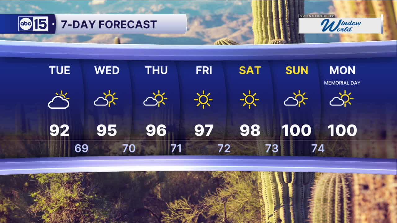
Temperatures will now start to climb little by little throughout the rest of the week.
Expect daytime highs in the low 90s on Tuesday, mid 90s Wednesday and Thursday and upper 90s by Thursday and Friday.
We're still expecting some windy conditions across Mohave County along the Colorado River on Tuesday. Those winds could lead to areas of blowing dust along I-40 near the AZ-CA stateline.
High pressure will gradually build in later this week, leading to a warm-up into Memorial Day weekend. Expect Valley temperatures back up near 100 degrees by Sunday and Monday.


2026 Sky Harbor Official Rainfall to date: 0.32" (-2.55" from average)
_________________________________________
Daily rainfall reports from all across the Valley can be found here.
__________________________________________
PHOENIX IS GETTING DRIER - LOWER RAINFALL AVERAGES NOW
Average Monsoon Rainfall in Phoenix (1981-2010): 2.71" of rain
NEW Average Monsoon Rainfall in Phoenix (1991-2020): 2.43" of rain
Average Yearly Rainfall in Phoenix (1981-2010): 8:03" of rain
NEW Average Yearly Rainfall in Phoenix (1991-2020): 7.22" of rain
__________________________________________
Share your weather photos and videos with us anytime: share@abc15.com.
______________________________________
