


PHOENIX — Monsoon storms developed across Arizona Monday evening, bringing a strong wall of dust to the Valley.
Follow the latest updates of Monday's storms below:
7 a.m.
Our crews have been out all morning, getting a look at some of the areas of damage around the Valley:
4 a.m., Tuesday, Aug. 26
Fewer than 300 customers with APS and SRP combined were still without power in the Valley, according to outage maps for the utilities.
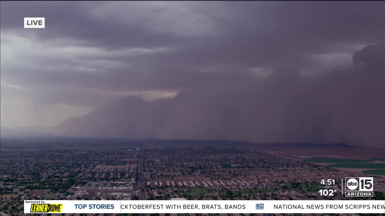
9:30 p.m.
9pm 📡 Update:
— The Flood Control District of Maricopa County (@maricopaflood) August 26, 2025
Impressive rainfall totals around Maricopa County this evening ⛈️ A wide swath of 0.25"-1.00" across most of the Phoenix Valley 💪 NW up by Wickenburg 1"-2" 🤯 #azwx #Monsoon2025
Keep track of the rain near you here:https://t.co/e3dpPWW9NY pic.twitter.com/sweskhIt1b
9:05 p.m.
a storm’s brewing… pic.twitter.com/hWXYoDU7S0
— Arizona Cardinals (@AZCardinals) August 26, 2025
8:20 p.m.
Epic haboob in the Phoenix metro area tonight.
— Amber Sullins (@AmberSullins) August 26, 2025
Take a look at the view from ABC15 viewer Lauren.
This one was a beast!
We'll know for sure what category it was on our new Phx-Dust scale tomorrow. It will definitely be high!#abc15 #abc15wx #azwx #az #wx #arizona #monsoon2025 pic.twitter.com/YBaBb4pm1w
8:10 p.m.
I-17 southbound under Camelback Road: The right lanes are closed due to flooding on the roadway. pic.twitter.com/wxU5Wevpzb
— Arizona DOT (@ArizonaDOT) August 26, 2025
7:00 p.m.
FLIGHT DIVERTED DUE TO HABOOB 💨✈️
— Jorge Torres (@JorgeTWeather) August 26, 2025
Allegiant Flight 2285 was forced to divert to Las Vegas because of the massive dust storm sweeping through the Valley. What an incredible sight!
📸: Heather Hibbeler #azwx pic.twitter.com/dS1wMk6tz8
6:48 p.m.
Due to the current storm we are experiencing traffic light outages and downed trees across town.
— Gilbert Police Dept. (@GilbertPolice) August 26, 2025
Please avoid travel this evening due to dangerous conditions. If you must travel, please drive with caution as we are working diligently to restore lights and clear roadways.
6:25 p.m.
Sources tell ABC15 the monsoon storm damaged portions of the roof over Terminal 4 at Phoenix Sky Harbor. The Sky Train operations are currently stopped. Fire alarms have gone off at multiple locations. The FAA Tower was evacuated during this time.
ABC15 viewer Janet Whalen shared the following photo of damage at Sky Harbor.

6:15 p.m.
About 57,000 customers are without power as monsoon storms sweep the Valley. Click here for more.
5:40 p.m.
This #Monsoon dust isn’t messing around. Current view from @PHXSkyHarbor. Please be safe! Tips for before, during and after storms at https://t.co/xyQirC4UC7. pic.twitter.com/3SdJQwAuUG
— City of Phoenix, AZ (@CityofPhoenixAZ) August 26, 2025
5:31 p.m.
Aviso de Tormenta Severa incluye Mesa AZ, Chandler AZ, Gilbert AZ hasta las 6:15 PM MST pic.twitter.com/LQv0l61vCq
— NWS Phoenix (@NWSPhoenix) August 26, 2025
5:29 p.m.
The FAA has issued a ground stop for Phoenix Sky Harbor International Airport until 6:30 p.m. due to the monsoon storms.
5:22 p.m.
🚨 Dust storm alert in Apache Junction! 🚨
— Apache Junction, AZ (@AJCityAZ) August 26, 2025
If you’re on the road, please pull over, turn off your lights, and wait until it passes. Driving in low visibility is extremely dangerous. Stay safe, AJ! pic.twitter.com/8QWx4l7s1A
5:15 p.m.
Dust storms are rolling into the East Valley, too. Again, you should NEVER drive into a dust storm. But if you're on the road when one hits, PULL ASIDE, STAY ALIVE! pic.twitter.com/G6ysKKEzZ3
— Arizona DOT (@ArizonaDOT) August 26, 2025
5:10 p.m.
Severe Thunderstorm Warning including Queen Creek AZ and Chandler Heights AZ until 6:00 PM MST pic.twitter.com/VO8HhlYa8c
— NWS Phoenix (@NWSPhoenix) August 26, 2025
5:00 p.m.
Sweet James Chopper showing the haboob approaching Queen Creek 👀@AmberSullins is doing a fantastic job explaining the impacts, including visibility and air quality concerns (asthma, Valley fever).#azwx pic.twitter.com/XEDCTGp0cS
— Jorge Torres (@JorgeTWeather) August 25, 2025
4:45 p.m.
A dust storm warning is in effect until 5:45 PM MST for I-10 near Avondale--Goodyear, AZ and I-10, I-17, US-60 near Phoenix--Mesa, AZ. pic.twitter.com/WfsUT5W2K8
— NWS Phoenix (@NWSPhoenix) August 25, 2025
4:30 p.m.
There's currently reduced visibility on I-10 near Picacho Peak due to a dust storm. Do NOT drive into it.
— Arizona DOT (@ArizonaDOT) August 25, 2025
You should NEVER drive into a dust storm, but if you encounter one and don’t have time to exit, remember to Pull Aside, Stay Alive!
Learn more at https://t.co/hSmGA4apfM. pic.twitter.com/eqbNyYEH9O
4:15 p.m.
A Dust Storm Warning has been issued, with reports of visibility as low as 50 feet. Be sure to use caution while on the road, pull aside stay alive. https://t.co/vZrRt642MX
— NWS Phoenix (@NWSPhoenix) August 25, 2025
2:25 p.m.
2:20 PM Radar Update: Strong to severe thunderstorms continue from Santa Cruz through western Pima. Storms over the Catalina/Rincons may move into the Tucson area over the next hour. Heavy rain, small hail, strong winds, and blowing dust possible with any storm. #azwx pic.twitter.com/NLiOj8GZp6
— NWS Tucson (@NWSTucson) August 25, 2025
11:00 a.m.
Monday, August 25, 2025: Here is a simulation of the forecast radar loop for this afternoon and evening. Use as an approximate timing and coverage of how the showers and storms are expected to evolve. Expect strong winds, blowing dust and locally heavy rain. #azwx #cawx pic.twitter.com/Ba36DLXzb1
— NWS Phoenix (@NWSPhoenix) August 25, 2025
10:40 a.m.
HEAVY RAINFALL & FLASH FLOODING POSSIBLE IN SOUTHERN AZ TODAY
— Jorge Torres (@JorgeTWeather) August 25, 2025
Southern AZ is expecting heavy rain today, with storms capable of dropping up to 2"/hour in some spots.
Certain areas, especially near the US-MX border, could see 1.5-2.5" in short bursts, according to @NWSWPC ⛈️ pic.twitter.com/ja8d5FUzeE
Want more news in your community? Add ABC15 as a preferred source on Google below:
![]()

