


PHOENIX — Monsoon moisture has been flowing into our state, bringing daily storm chances. Now those storm chances are going up and so is the risk for flash flooding.
High pressure is situated near the Four Corners, helping pull monsoon moisture into Arizona.
Over the coming days, we're also tracking an area of low pressure that will move into our state from the east. This storm system will give us the lift we need to get more storms going around the state.

We're seeing more widespread showers on Friday morning, with the threat of daily showers and thunderstorms continuing through the weekend.
With several days of thunderstorms that could produce heavy rain, our risk for flash flooding is going up.
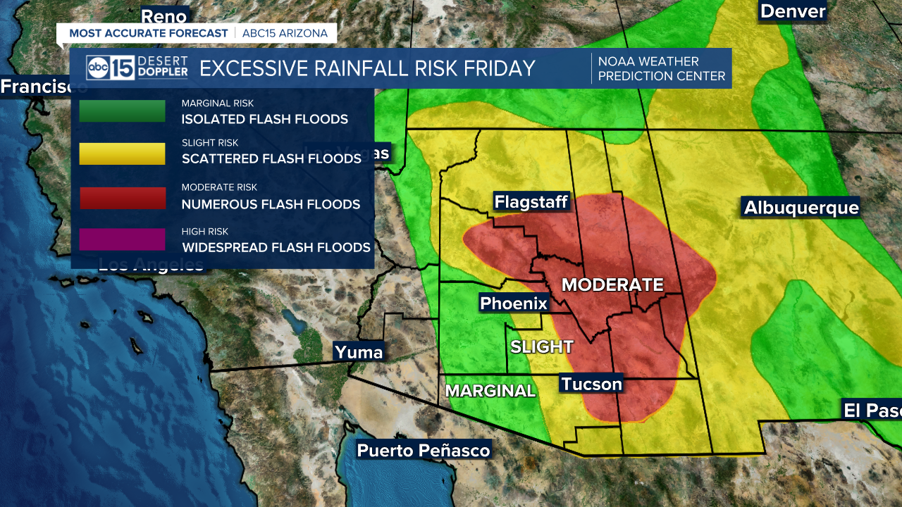
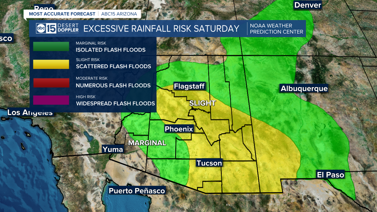
A Flash Flood Watch is now in effect for the Phoenix area and most of Arizona through Saturday.

The biggest areas at risk for flash flooding will continue to be around our wildfire burn scars, but we could see flooding rain in the Valley and other locations, too.
Spots in the Valley have already seen more than one to two inches since storms began hitting hard on Thursday night. The Phoenix area could see as much as an inch and a half of rain through the weekend. See latest rainfall totals here.

In addition to the flooding threat, there is also a risk of strong or severe thunderstorms that produce damaging winds.
Make sure you're staying weather-aware in the coming days and be prepared to seek shelter as storms develop.
Also, remember to avoid driving through any flooded washes or roadways.
