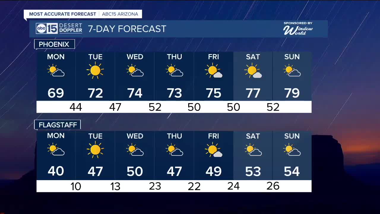


PHOENIX — The winter storm has moved out of Arizona, leaving behind chilly mornings and cooler afternoons. That cool stretch, however, will be short-lived.
Morning lows will remain in the 40s across the Valley through Wednesday, so a jacket will still be useful during the early hours. Afternoon highs will top out in the upper 60s on Monday before rebounding into the 70s beginning Tuesday.
A gradual warm-up is expected through the week as high pressure builds back into the region. Some periods of increased cloud cover are possible, particularly midweek, as a weak disturbance passes through. Once it moves out, the ridge of high pressure will strengthen, allowing temperatures to climb further.
By the end of the week, highs are forecast to reach the mid-70s, with upper 70s to near 80 degrees possible by the weekend.


2026 Sky Harbor Official Rainfall to date: 0.18" (-0.52" from average)
_________________________________________
2025 Sky Harbor Official Rainfall: 8.31" (+1.09" from average)
Monsoon 2025 Sky Harbor Official Rainfall: 2.76" (+0.33" from average)
__________________________________________
Daily rainfall reports from all across the Valley can be found here.
__________________________________________
PHOENIX IS GETTING DRIER - LOWER RAINFALL AVERAGES NOW
Average Monsoon Rainfall in Phoenix (1981-2010): 2.71" of rain
NEW Average Monsoon Rainfall in Phoenix (1991-2020): 2.43" of rain
Average Yearly Rainfall in Phoenix (1981-2010): 8:03" of rain
NEW Average Yearly Rainfall in Phoenix (1991-2020): 7.22" of rain
__________________________________________
Share your weather photos and videos with us anytime: share@abc15.com.
______________________________________
