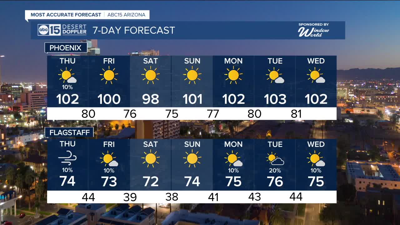


PHOENIX — Isolated showers and thunderstorms are still possible, especially in eastern and southeastern Arizona.
Here in the Valley, we'll see a slight chance of an isolated storm or two through Thursday afternoon.
As a storm system passes to our north, we are also seeing winds pick up across Arizona this week.
Here in the Valley, peak gusts could hit 30 mph, with gusts up to 45 mph across parts of the high country.
Wind Advisories are in effect until 7 p.m. tonight across much of northern Arizona, including places like Lake Havasu City, Bullhead City, Kingman, Prescott, Flagstaff, Williams, the Grand Canyon, Heber, Winslow, and Holbrook.
Winds will back off a bit by Friday, but it's still looking breezy across much of the state.
As those winds usher in some cooler air, temperatures will drop nearly 10 degrees in many Arizona spots by Friday.
Valley highs will drop into the upper 90s with early morning lows in the low to mid 70s heading into the weekend.


2025 Sky Harbor Official Rainfall to date: 2.15" (-2.86" from average)
Monsoon 2025 Sky Harbor Official Rainfall: 0.68" (-1.39" from average)
__________________________________________
Daily rainfall reports from all across the Valley can be found here.
__________________________________________
PHOENIX IS GETTING DRIER - LOWER RAINFALL AVERAGES NOW
Average Monsoon Rainfall in Phoenix (1981-2010): 2.71" of rain
NEW Average Monsoon Rainfall in Phoenix (1991-2020): 2.43" of rain
Average Yearly Rainfall in Phoenix (1981-2010): 8:03" of rain
NEW Average Yearly Rainfall in Phoenix (1991-2020): 7.22" of rain
__________________________________________
Share your weather photos and videos with us anytime: share@abc15.com.
______________________________________
