



PHOENIX — A storm system is bringing winds, rain and thunderstorms to Arizona this weekend.
Showers and a few embedded thunderstorms will continue moving through the Valley and across the state through Sunday.
The best chance for rain in the Valley will be from Saturday evening through Sunday morning.
Rainfall will be light overall with only a few hundredths of an inch expected in the Phoenix area.
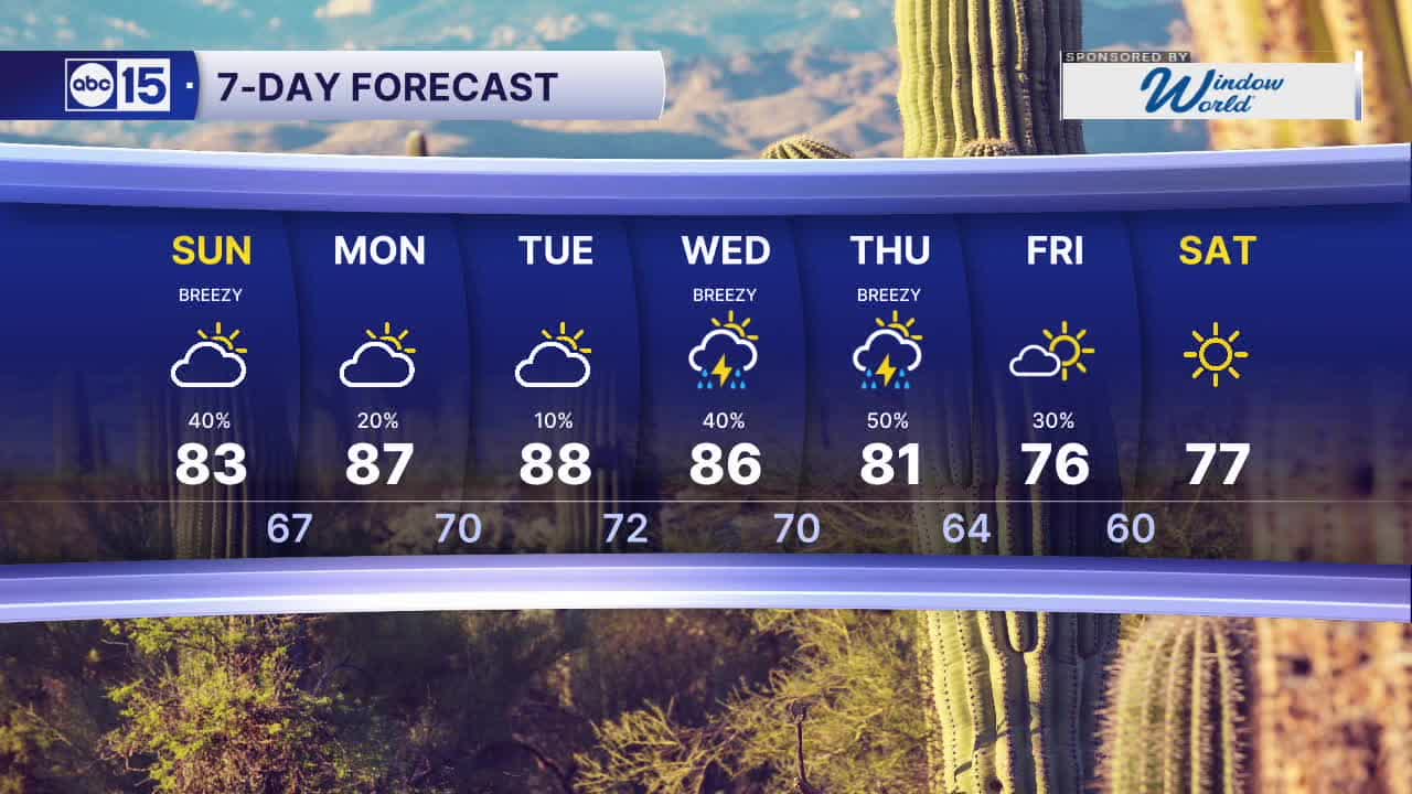
Winds will pick up again on Sunday with peak wind gusts near 25 mph in the Phoenix Metro.
Temperatures will top out in the low 80s on Sunday, with early morning lows in the 60s.
Then we'll see a gradual warm-up to kick off the week. Valley highs will top out out near normal, in the mid to upper 80s.
A few storms are possible early Monday too before this storm system finally clears out of our region.
Then we turn our attention to another storm system coming in from the west. That area of low pressure will bring even higher rain chances, more wind, and another dose of cool air as it moves across Arizona.
Rain chances ramp up on Wednesday and Thursday, with storms lingering into Friday before we dry out.
Temperatures will plunge back into the 70s by the end of the week, too!
Stay tuned for more updates as we get closer.


2026 Sky Harbor Official Rainfall to date: 3.19" (-2.46" from average)
Monsoon 2026 Sky Harbor Official Rainfall: 2.46" (+0.03" from average)
__________________________________________
Daily rainfall reports from all across the Valley can be found here.
__________________________________________
PHOENIX IS GETTING DRIER - LOWER RAINFALL AVERAGES NOW
Average Monsoon Rainfall in Phoenix (1981-2010): 2.71" of rain
NEW Average Monsoon Rainfall in Phoenix (1991-2020): 2.43" of rain
Average Yearly Rainfall in Phoenix (1981-2010): 8:03" of rain
NEW Average Yearly Rainfall in Phoenix (1991-2020): 7.22" of rain
__________________________________________
Share your weather photos and videos with us anytime: share@abc15.com.
______________________________________
