

PHOENIX — It's an ABC15 Weather Action Day as chances for monsoon storms and flooding impact parts of Arizona.
Monsoon moisture is flowing in, along with some tropical moisture from Lorena to our south, and that is increasing the threat for flooding across our state.
Across southeastern Arizona, a Flood Watch is in effect from Friday afternoon until Saturday afternoon. Rainfall amounts of 1 to 2 inches, with up to 4 inches in the mountains, are possible across this part of our state.
We could see blowing dust, damaging wind gusts, dangerous cloud-to-ground lightning, and pockets of heavy rain that could lead to flooding with any of the storms that move through.
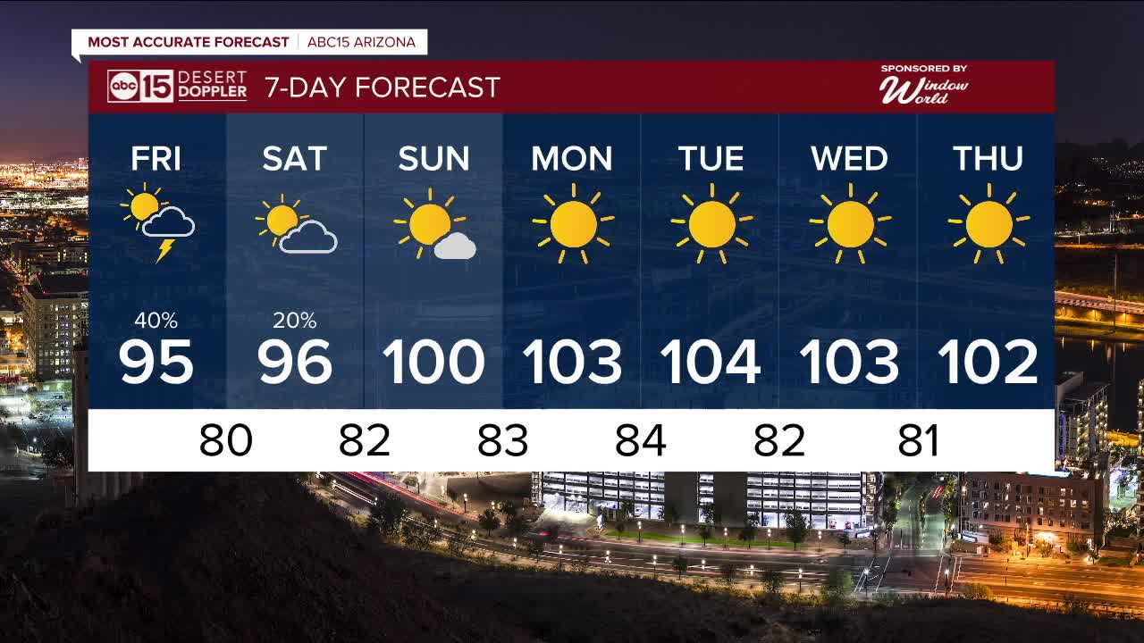
Here in the Valley, we'll see a slight chance of storms through Saturday.
Increased cloud coverage and moisture is also leading to a nice cool-down in the Valley.
Daytime highs are falling to the mid-90s and will stay there through Saturday, putting us nearly 10 degrees below normal for early September.
Drier air will move in by Sunday, clearing out any chances for storms.
Expect sunny and dry conditions next week with highs around 102 to 104 degrees in Phoenix.


2025 Sky Harbor Official Rainfall to date: 2.15" (-2.73" from average)
Monsoon 2025 Sky Harbor Official Rainfall: 0.68" (-1.28" from average)
Daily rainfall reports from all across the Valley can be found here.
__________________________________________
PHOENIX IS GETTING DRIER - LOWER RAINFALL AVERAGES NOW
Average Monsoon Rainfall in Phoenix (1981-2010): 2.71" of rain
NEW Average Monsoon Rainfall in Phoenix (1991-2020): 2.43" of rain
Average Yearly Rainfall in Phoenix (1981-2010): 8:03" of rain
NEW Average Yearly Rainfall in Phoenix (1991-2020): 7.22" of rain
__________________________________________
Share your weather photos and videos with us anytime: share@abc15.com.
______________________________________
