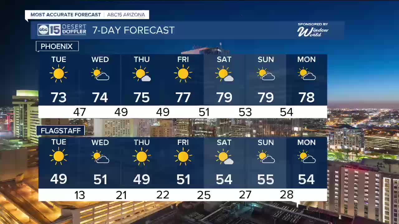


PHOENIX — High pressure is making a comeback this week, sending temperatures soaring once again.
Valley highs will be back in the 70s starting Tuesday and continue to climb day by day through the end of the week.
Mornings will still be chilly. Expect overnight temperatures to drop into the 40s across the Valley all week.
We'll see more move back in by mid-week, but there are no chances for rain.
Temperatures will flirt with the 80s again in parts of the Valley next weekend, putting us nearly ten degrees above normal for this time of year.


2026 Sky Harbor Official Rainfall to date: 0.18" (-0.57" from average)
_________________________________________
2025 Sky Harbor Official Rainfall: 8.31" (+1.09" from average)
Monsoon 2025 Sky Harbor Official Rainfall: 2.76" (+0.33" from average)
__________________________________________
Daily rainfall reports from all across the Valley can be found here.
__________________________________________
PHOENIX IS GETTING DRIER - LOWER RAINFALL AVERAGES NOW
Average Monsoon Rainfall in Phoenix (1981-2010): 2.71" of rain
NEW Average Monsoon Rainfall in Phoenix (1991-2020): 2.43" of rain
Average Yearly Rainfall in Phoenix (1981-2010): 8:03" of rain
NEW Average Yearly Rainfall in Phoenix (1991-2020): 7.22" of rain
__________________________________________
Share your weather photos and videos with us anytime: share@abc15.com.
______________________________________
