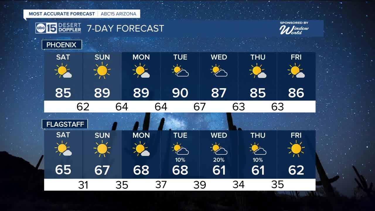


PHOENIX — We have been enjoying prime fall weather around Arizona, while mornings will remain cool into the weekend, afternoon temperatures are set to rise.
High pressure builds back in over the weekend, warming temperatures into the mid to upper 80s across the Phoenix metro area. However, morning lows will stick in the upper 50s to lower 60s.
The heat ramps up even more early next week as Valley highs push near or into the low 90s Monday and Tuesday.
We're also tracking a storm system offshore that could move into Arizona toward the middle of next week.
Right now, it's not looking like it will have a lot of moisture as it moves it, but we could see a few isolated showers across Arizona late Tuesday and Wednesday.


2025 Sky Harbor Official Rainfall to date: 7.49" (+1.82" from average)
Monsoon 2025 Sky Harbor Official Rainfall: 2.76" (+0.33" from average)
__________________________________________
Daily rainfall reports from all across the Valley can be found here.
__________________________________________
PHOENIX IS GETTING DRIER - LOWER RAINFALL AVERAGES NOW
Average Monsoon Rainfall in Phoenix (1981-2010): 2.71" of rain
NEW Average Monsoon Rainfall in Phoenix (1991-2020): 2.43" of rain
Average Yearly Rainfall in Phoenix (1981-2010): 8:03" of rain
NEW Average Yearly Rainfall in Phoenix (1991-2020): 7.22" of rain
__________________________________________
Share your weather photos and videos with us anytime: share@abc15.com.
______________________________________
