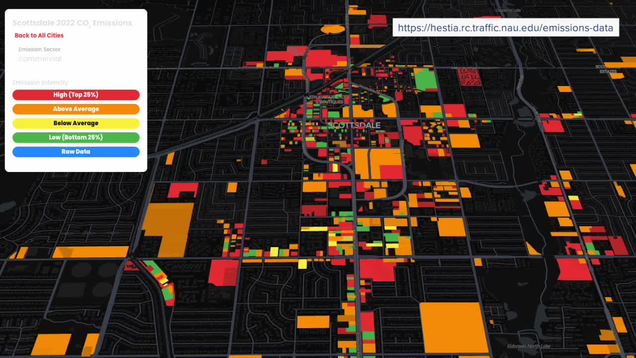


Dr. Kevin Gurney, a professor at Northern Arizona University, debuted the first-ever building- and street-level maps of carbon dioxide emissions for Phoenix, Tucson, and Flagstaff.
The data, years in the making, offers Arizona residents a unique look at their community’s carbon footprint with neighborhood-level detail.
This research, part of the Southwest Urban Integrated Field Laboratory, provides powerful insights for city leaders, planners, and residents on areas where we can improve our carbon footprint.
ABC15 Meteorologist Justin Hobbs heard from Dr. Gurney on what is contributing to our footprint and what it means for our communities.
Our team also talked with Valley residents to hear about how they perceive their neighborhood's emissions and what ideas they have to do a better job moving toward a healthier, more sustainable future.
Watch the full report in the video player above.
Want more news in your community? Add ABC15 as a preferred source on Google below:
![]()

