



PHOENIX — Warm, windy and dry weather will continue through the rest of the weekend as high pressure remains in control.
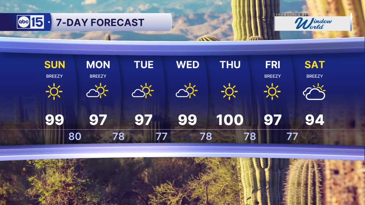
Look for Valley highs in the upper 90s on Sunday and into next week.
Winds will again pick up across the state on Sunday, with the strongest winds located across southeast Arizona where a Wind Advisory is in effect from 8 am to 2 pm. Gusts there could reach as high as 40 to 55 mph.
Here in the Valley, winds will come in from the east-southeast on Sunday, with peak gusts near 30 to 35 mph through the day.
Temperatures will climb even higher by mid to late week. Phoenix could reach the triple digits by Thursday.
On average, Phoenix sees its last 100-degree day in early October, but there are some years the triple digit heat hangs on until just days before Halloween.
Temperatures do look to come down again by next weekend, as clouds and rain chances return too. Stay tuned for updates as we get closer.


2026 Yearly Sky Harbor Rainfall to-date: 2.78" (-2.63" from average)
2026 Monsoon Rainfall: 2.46" (+0.03" from average)
__________________________________________
Daily rainfall reports from all across the Valley can be found here.
__________________________________________
PHOENIX IS GETTING DRIER - LOWER RAINFALL AVERAGES NOW
Average Monsoon Rainfall in Phoenix (1981-2010): 2.71" of rain
NEW Average Monsoon Rainfall in Phoenix (1991-2020): 2.43" of rain
Average Yearly Rainfall in Phoenix (1981-2010): 8:03" of rain
NEW Average Yearly Rainfall in Phoenix (1991-2020): 7.22" of rain
__________________________________________
Share your weather photos and videos with us anytime: share@abc15.com.
______________________________________
