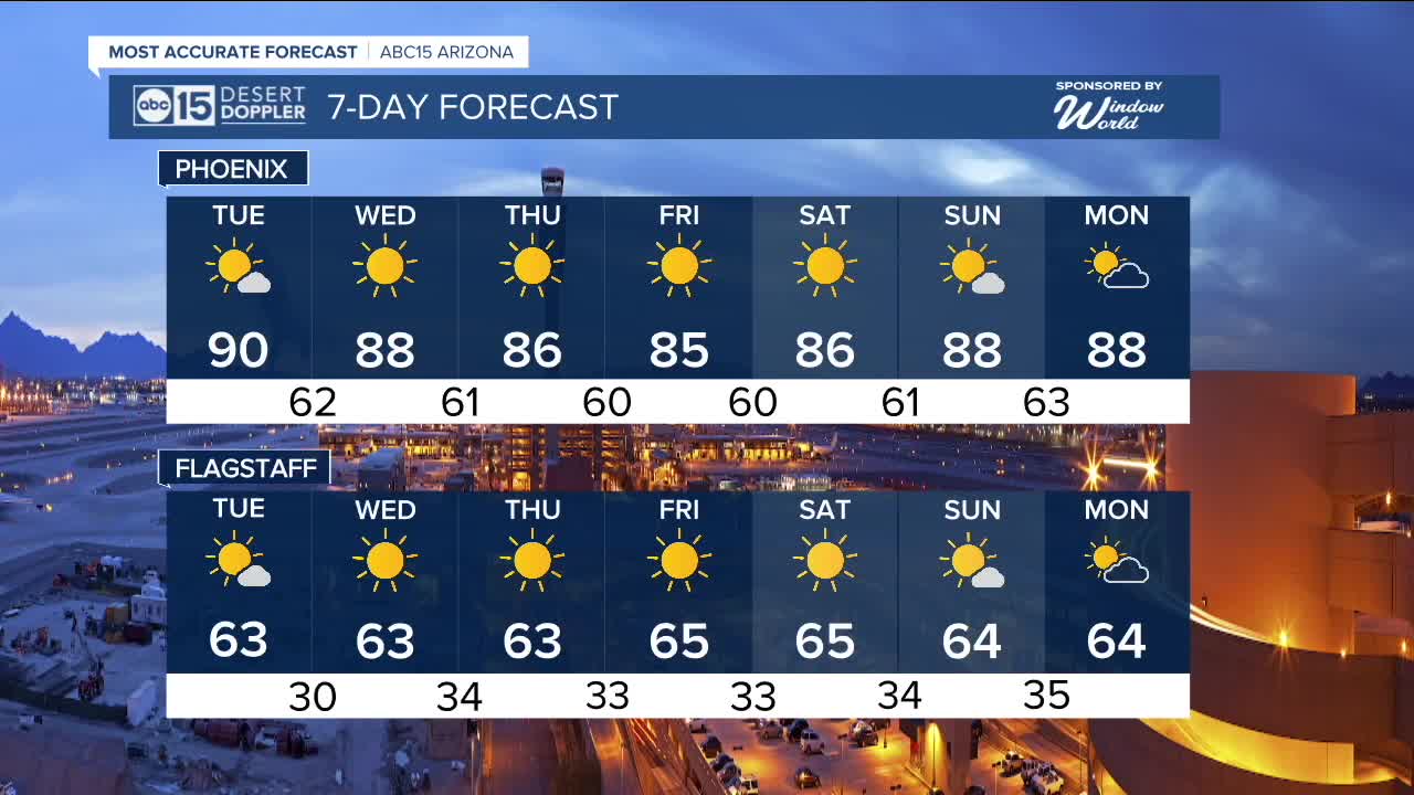


PHOENIX — High pressure is in control and keeping temperatures warmer than normal for early November.
Most days this week will be in the mid to upper 80s across the Valley, but Phoenix may climb to 90 degrees on Tuesday.
Typically, we see our last 90-degree day of the year around October 30th, but we have hit the 90s as late as mid November back in 2020.
Last year, our last day in the 90s was October 28th.
We're expecting some passing clouds at times, but no chances for rain as our forecast stays dry across all across Arizona this week.


_________________________________________
2025 Sky Harbor Official Rainfall to date: 7.49" (+1.53" from average)
Monsoon 2025 Sky Harbor Official Rainfall: 2.76" (+0.33" from average)
________________________________________
Daily rainfall reports from all across the Valley can be found here.
__________________________________________
PHOENIX IS GETTING DRIER - LOWER RAINFALL AVERAGES NOW
Average Monsoon Rainfall in Phoenix (1981-2010): 2.71" of rain
NEW Average Monsoon Rainfall in Phoenix (1991-2020): 2.43" of rain
Average Yearly Rainfall in Phoenix (1981-2010): 8:03" of rain
NEW Average Yearly Rainfall in Phoenix (1991-2020): 7.22" of rain
__________________________________________
Share your weather photos and videos with us anytime: share@abc15.com.
______________________________________
