

PHOENIX — It's been a nice start to December across Arizona.
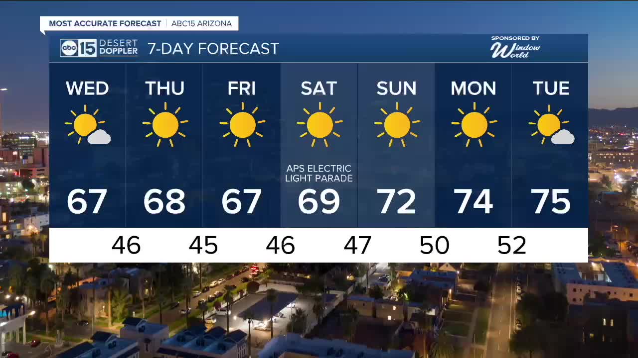
Temperatures are pretty close to average with Valley neighborhoods topping out in the upper 60s to low 70s throughout the week.
Overnight lows will stay chilly as temperatures drop into the mid 40s to low 50s across the Phoenix metro area.
We are also tracking a storm system set to swing into northern Arizona on Wednesday.
It's looking fairly weak overall, but we could see some snow along the Mogollon Rim, as well as in the White Mountains and Chuska Mountains, Wednesday afternoon through early Thursday morning.
The snow level will be around 5,000 feet and only an inch or two is expected.
Behind the storm, northerly winds will accelerate down the Colorado River Valley leading to a Wind Advisory from 10 a.m. until 7 p.m. in Mohave County. Watch out for gusts at 35 to 40 mph there in places like Bullhead City and Lake Havasu City.
Here in the Valley, wind will stay light with just a few clouds passing through.
High pressure returns again over the weekend and early next week, keeping our forecast dry and warming us back up into the 70s.


2025 Sky Harbor Official Rainfall to date: 8.28" (+1.76" from average)
Monsoon 2025 Sky Harbor Official Rainfall: 2.76" (+0.33" from average)
__________________________________________
Daily rainfall reports from all across the Valley can be found here.
__________________________________________
PHOENIX IS GETTING DRIER - LOWER RAINFALL AVERAGES NOW
Average Monsoon Rainfall in Phoenix (1981-2010): 2.71" of rain
NEW Average Monsoon Rainfall in Phoenix (1991-2020): 2.43" of rain
Average Yearly Rainfall in Phoenix (1981-2010): 8:03" of rain
NEW Average Yearly Rainfall in Phoenix (1991-2020): 7.22" of rain
__________________________________________
Share your weather photos and videos with us anytime: share@abc15.com.
______________________________________
