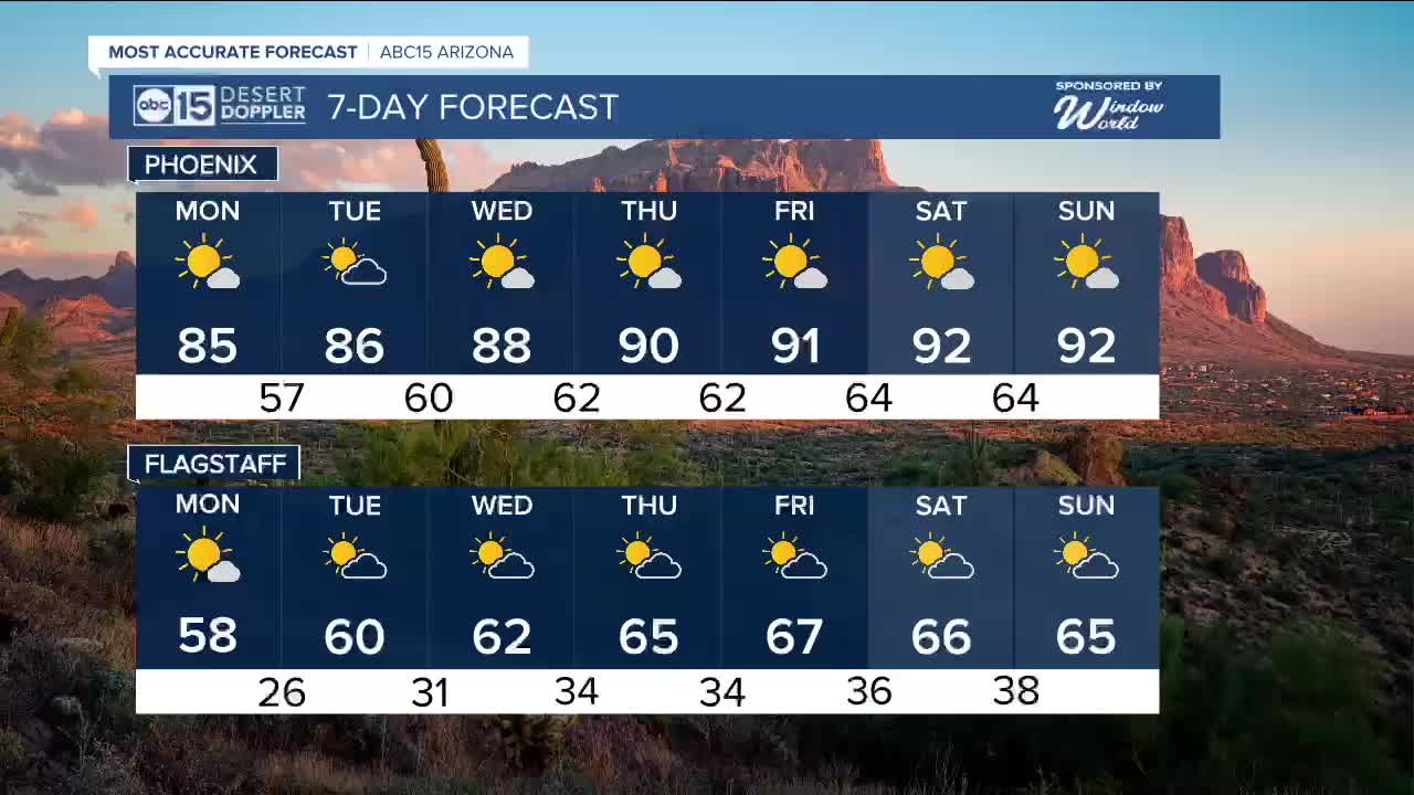


PHOENIX — We’ve already seen a big warm-up in the Valley, from Friday’s high of 64 to Sunday’s 81, and more heat is on the way.
A ridge of high pressure over the Southwest is intensifying, setting the stage for a record-challenging stretch of warmth.
For Monday morning, lows will still be cool, starting in the lower 50s, and by the afternoon, we will approach the mid 80s.
Highs continue to climb each day. By Thursday through Sunday, Valley temperatures could reach the 90s, about 20 degrees above normal.
If we hit the 90s, it would be one of the earliest stretches of 90-degree weather Phoenix has seen.
The average first 90-degree day typically falls around March 30, so this would be nearly a month early.
Historically, Phoenix has recorded only eight February days with temperatures in the 90s, making this week’s warmth a rare event.


2026 Sky Harbor Official Rainfall to date: 0.26" (-1.26" from average)
_________________________________________
2025 Sky Harbor Official Rainfall: 8.31" (+1.09" from average)
Monsoon 2025 Sky Harbor Official Rainfall: 2.76" (+0.33" from average)
__________________________________________
Daily rainfall reports from all across the Valley can be found here.
__________________________________________
PHOENIX IS GETTING DRIER - LOWER RAINFALL AVERAGES NOW
Average Monsoon Rainfall in Phoenix (1981-2010): 2.71" of rain
NEW Average Monsoon Rainfall in Phoenix (1991-2020): 2.43" of rain
Average Yearly Rainfall in Phoenix (1981-2010): 8:03" of rain
NEW Average Yearly Rainfall in Phoenix (1991-2020): 7.22" of rain
__________________________________________
Share your weather photos and videos with us anytime: share@abc15.com.
______________________________________
