

PHOENIX — A disturbance or saturated air moved into Arizona on Sunday, increasing clouds and bringing showers and thunderstorms to part of the state.
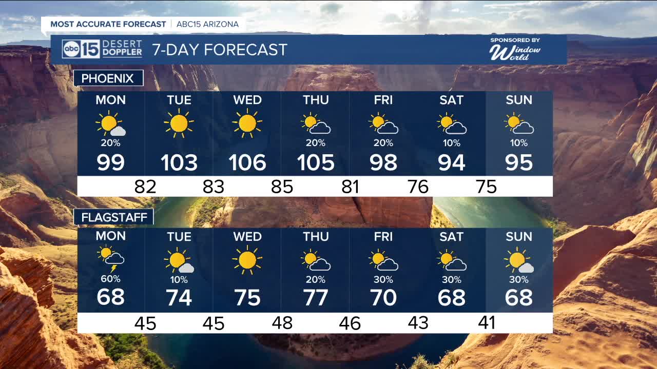
That same disturbance sticks around into Monday; this will keep storm chance elevated, especially for the northern tier of the state, along with scattered storms to our southeast. Here in the Valley, there is still a chance for some showers, but cloud coverage will be more intermittent in the afternoon.
Temperatures will take a step down Monday, too, with highs in the upper 90s and overnight lows in the 70s to lower 80s as we kick off the official start to fall
By the middle of the week, high pressure builds back in, drying us out and heating us up.
Phoenix could hit around 105 on Wednesday before another cool-down arrives later in the week with another round of storm chances.


2025 Sky Harbor Official Rainfall to date: 2.38" (-2.83" from average)
Monsoon 2025 Sky Harbor Official Rainfall: 0.91" (-1.37" from average)
__________________________________________
Daily rainfall reports from all across the Valley can be found here.
__________________________________________
PHOENIX IS GETTING DRIER - LOWER RAINFALL AVERAGES NOW
Average Monsoon Rainfall in Phoenix (1981-2010): 2.71" of rain
NEW Average Monsoon Rainfall in Phoenix (1991-2020): 2.43" of rain
Average Yearly Rainfall in Phoenix (1981-2010): 8:03" of rain
NEW Average Yearly Rainfall in Phoenix (1991-2020): 7.22" of rain
__________________________________________
Share your weather photos and videos with us anytime: share@abc15.com.
______________________________________
