

PHOENIX — Big changes are on the way as monsoon moisture increases across Arizona.
At the same time, a storm system will approach from the west and tap into lingering moisture from the remnants of what was once Tropical Storm Mario.
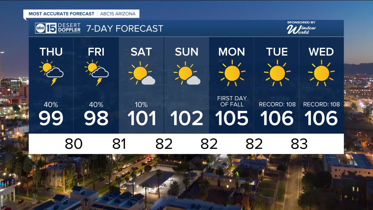
All of these factors combined could lead to severe storms across parts of Arizona.
Here in the Valley, our best chances for rain and thunderstorms will be Thursday evening through Friday morning.
Any storms that develop could bring gusty winds, blowing dust, frequent cloud-to-ground lightning, and heavy downpours capable of causing localized flooding.
Temperatures will drop into the upper 90s Thursday and Friday, but it will feel muggy as all that moisture surges in.
High pressure will build in again over the weekend, bringing drier air and hotter temperatures.
Phoenix will climb back into the low 100s on Saturday and Sunday before topping 105 again for the first few days of fall.


2025 Sky Harbor Official Rainfall to date: 2.15" (-2.99" from average)
Monsoon 2025 Sky Harbor Official Rainfall: 0.68" (-1.53" from average)
__________________________________________
Daily rainfall reports from all across the Valley can be found here.
__________________________________________
PHOENIX IS GETTING DRIER - LOWER RAINFALL AVERAGES NOW
Average Monsoon Rainfall in Phoenix (1981-2010): 2.71" of rain
NEW Average Monsoon Rainfall in Phoenix (1991-2020): 2.43" of rain
Average Yearly Rainfall in Phoenix (1981-2010): 8:03" of rain
NEW Average Yearly Rainfall in Phoenix (1991-2020): 7.22" of rain
__________________________________________
Share your weather photos and videos with us anytime: share@abc15.com.
______________________________________
