

PHOENIX — Big changes are moving in as monsoon moisture increases across Arizona.
Scattered showers and thunderstorms are moving through our state with more to come in the next 24 hours.
A Flood Watch is in effect until 2 a.m. Friday morning for La Paz and Yuma counties, including places like Yuma and Quartzsite.
Excessive runoff could lead to flooding along rivers, creeks, streams, and other low-lying areas. Low-water crossings may become impassable in this part of the state.
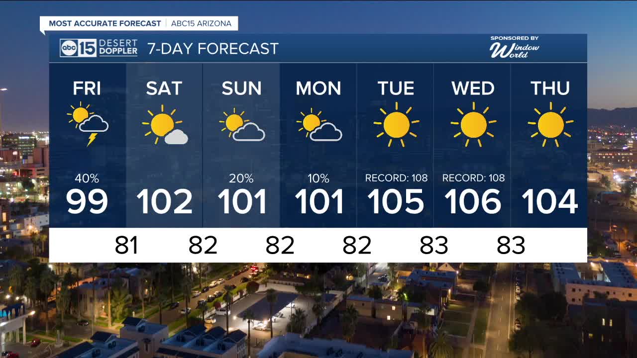
Here in the Valley, our best chances for rain and thunderstorms will be Thursday evening through Friday morning.
Any storms that develop could bring strong wind gusts, blowing dust, frequent lightning, and heavy downpours that may cause localized flooding.
Temperatures will drop into the upper 90s to end the week, but it will feel muggy as moisture surges in.
Another disturbance will increase cloud coverage on Sunday and Monday and could bring more shower and thunderstorm activity to parts of our state, including right here in the Valley.
Then, high pressure will take over, bringing drier air and hotter conditions to Arizona for the first few days of fall.
Phoenix could top 105 degrees again by next Tuesday and Wednesday, putting us just a few degrees shy of the daily records.


2025 Sky Harbor Official Rainfall to date: 2.15" (-3.01" from average)
Monsoon 2025 Sky Harbor Official Rainfall: 0.68" (-1.55" from average)
__________________________________________
Daily rainfall reports from all across the Valley can be found here.
__________________________________________
PHOENIX IS GETTING DRIER - LOWER RAINFALL AVERAGES NOW
Average Monsoon Rainfall in Phoenix (1981-2010): 2.71" of rain
NEW Average Monsoon Rainfall in Phoenix (1991-2020): 2.43" of rain
Average Yearly Rainfall in Phoenix (1981-2010): 8:03" of rain
NEW Average Yearly Rainfall in Phoenix (1991-2020): 7.22" of rain
__________________________________________
Share your weather photos and videos with us anytime: share@abc15.com.
______________________________________
