

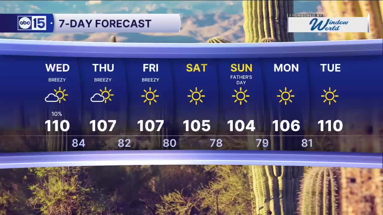


PHOENIX — There are still slight chances of isolated storms over the higher terrain and the Valley on this evening and Wednesday too.
We're also seeing sizzling heat, fueling storms activity around the state.
Phoenix will flirt with 110 degrees again Wednesday, which is nearly five degrees above average for mid-June.
Up north, as temperatures approach 110 degrees at the bottom of the Grand Canyon, an Extreme Heat Warning will be in effect for areas below 4,000 feet in elevation until 8 p.m. Wednesday.
With dangerously hot temperatures like these, make sure to stay hydrated and limit your time outside during the late morning and afternoon hours.
Drier air moves in by the end of the week as temperatures drop back closer to normal heading into the weekend.
Right now, Father's Day on Sunday is looking sunny and dry with a high of 104 in Phoenix.


2026 Sky Harbor Official Rainfall to date: 0.32" (-2.61" from average)
Monsoon 2026 Sky Harbor Official Rainfall to date: 0.00" (-0.01" from average)
__________________________________________
Daily rainfall reports from all across the Valley can be found here.
__________________________________________
PHOENIX IS GETTING DRIER - LOWER RAINFALL AVERAGES NOW
Average Monsoon Rainfall in Phoenix (1981-2010): 2.71" of rain
NEW Average Monsoon Rainfall in Phoenix (1991-2020): 2.43" of rain
Average Yearly Rainfall in Phoenix (1981-2010): 8:03" of rain
NEW Average Yearly Rainfall in Phoenix (1991-2020): 7.22" of rain
__________________________________________
Share your weather photos and videos with us anytime: share@abc15.com.
______________________________________
