



PHOENIX — The high country isn't quite finished, holding onto enough moisture and instability for a few scattered storms this afternoon.
The Valley is drying out and stays that way through the rest of the week.
An Extreme Heat Warning remains in effect for the Grand Canyon, where temperatures near the canyon floor are forecast to approach 110 degrees. The warning covers elevations below 4,000 feet and runs until 8 p.m.
Gusty winds and dry air are raising fire danger across parts of the state too. A Red Flag Warning takes effect Friday across northwestern Arizona, where those conditions can turn one small spark into a fast-moving fire.
Hold off on outdoor burning. Don't flick a cigarette out the window, and check your vehicle before hitting the road. Nothing should be dragging underneath that could throw sparks onto dry grass.
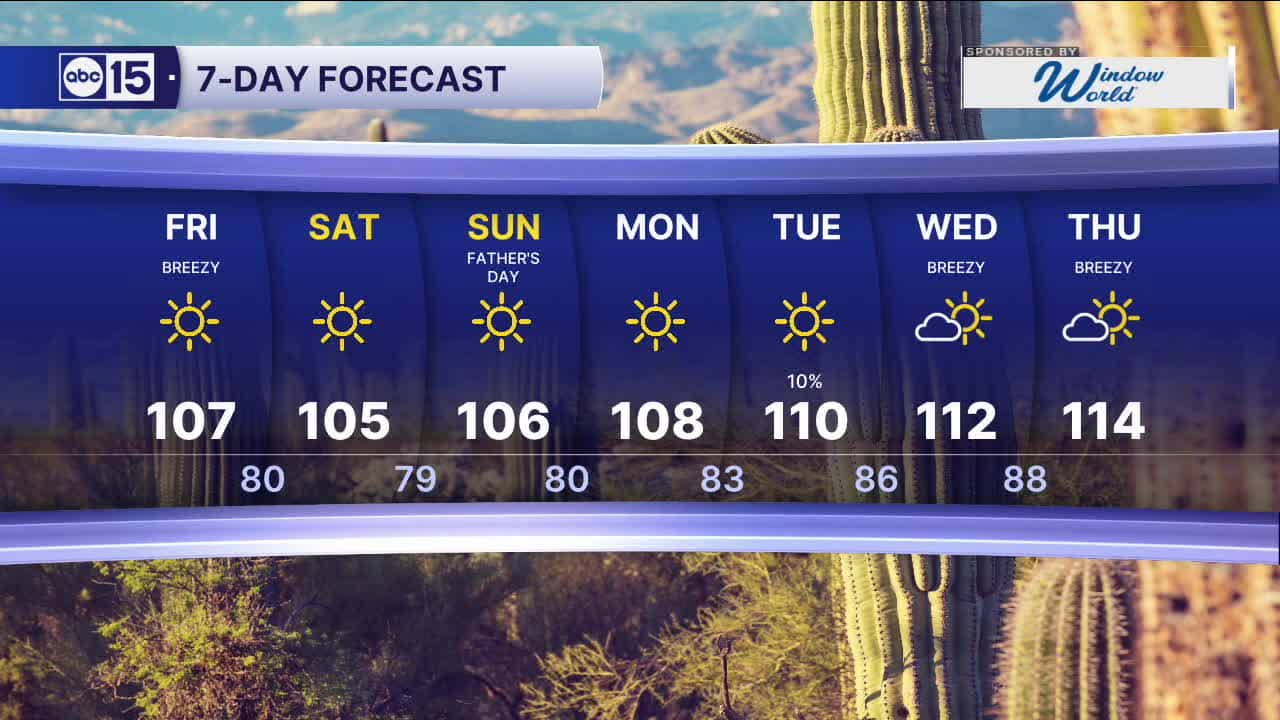
That same dry air is also working in our favor on temperatures, trending back toward seasonal averages heading into the weekend. Father's Day looks sunny and dry, with Phoenix topping out near 106.
High pressure rebuilds over the Desert Southwest next week, sending our numbers right back toward 110 and possibly higher.


2026 Sky Harbor Official Rainfall to date: 0.32" (-2.61" from average)
Monsoon 2026 Sky Harbor Official Rainfall to date: 0.00" (-0.01" from average)
__________________________________________
Daily rainfall reports from all across the Valley can be found here.
__________________________________________
PHOENIX IS GETTING DRIER - LOWER RAINFALL AVERAGES NOW
Average Monsoon Rainfall in Phoenix (1981-2010): 2.71" of rain
NEW Average Monsoon Rainfall in Phoenix (1991-2020): 2.43" of rain
Average Yearly Rainfall in Phoenix (1981-2010): 8:03" of rain
NEW Average Yearly Rainfall in Phoenix (1991-2020): 7.22" of rain
__________________________________________
Share your weather photos and videos with us anytime: share@abc15.com.
______________________________________
