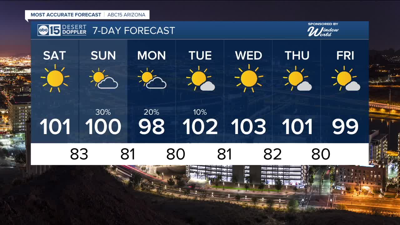


PHOENIX — It's going to be a dry start to the weekend in the Valley, but storm chances are still in play across the high country.
Valley temperatures will climb into the low 100s on Saturday afternoon, putting us right near normal for this time of year.
Then, another disturbance will increase cloud coverage on Sunday and Monday and could bring more shower and thunderstorm activity to parts of our state, including right here in the Valley.
Temperatures will drop, too.
Look for highs in the upper 90s on Monday with overnight lows in the 70s across much of the Valley.
High pressure will take over toward the middle of next week, bringing in drier air and hotter conditions to Arizona for the first few days of fall.
Phoenix could top out near 103 degrees next Wednesday before another dose of cooler air arrives toward the end of next week.


2025 Sky Harbor Official Rainfall to date: 2.38" (-2.80" from average)
Monsoon 2025 Sky Harbor Official Rainfall: 0.91" (-1.33" from average)
__________________________________________
Daily rainfall reports from all across the Valley can be found here.
__________________________________________
PHOENIX IS GETTING DRIER - LOWER RAINFALL AVERAGES NOW
Average Monsoon Rainfall in Phoenix (1981-2010): 2.71" of rain
NEW Average Monsoon Rainfall in Phoenix (1991-2020): 2.43" of rain
Average Yearly Rainfall in Phoenix (1981-2010): 8:03" of rain
NEW Average Yearly Rainfall in Phoenix (1991-2020): 7.22" of rain
__________________________________________
Share your weather photos and videos with us anytime: share@abc15.com.
______________________________________
