

PHOENIX — High fire danger sticks with us this week across parts of Arizona.
Red Flag Warnings are now extended through Monday for eastern Coconino along with much of Navajo and Apache counties. Wind gusts there could top 40 mph.
There's a good chance those warnings stretch into Tuesday. A Fire Weather Watch is already up for those same areas.
With fire risk this high, please hold off on any outdoor burning. Don't toss cigarettes from your vehicle, and double-check that nothing is dragging from your car that could throw sparks.
So what's driving all this wind?
An area of low pressure is digging into the western U.S. That system hangs around through midweek before it lifts out, letting a ridge of high pressure build in from the south later this week.
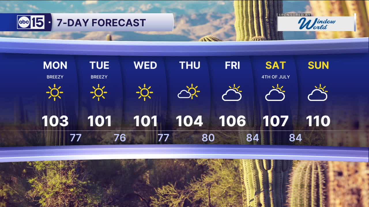
Until then, temperatures stay just a touch below average. Valley highs hold in the lower 100s, but by next weekend, the heat starts cranking back up.
Look for highs near 107 around Independence Day, and that's right about normal for early July.


2026 Sky Harbor Official Rainfall to date: 0.32" (-2.62" from average)
Monsoon 2026 Sky Harbor Official Rainfall to date: 0.00" (-0.02" from average)
__________________________________________
Daily rainfall reports from all across the Valley can be found here.
__________________________________________
PHOENIX IS GETTING DRIER - LOWER RAINFALL AVERAGES NOW
Average Monsoon Rainfall in Phoenix (1981-2010): 2.71" of rain
NEW Average Monsoon Rainfall in Phoenix (1991-2020): 2.43" of rain
Average Yearly Rainfall in Phoenix (1981-2010): 8:03" of rain
NEW Average Yearly Rainfall in Phoenix (1991-2020): 7.22" of rain
__________________________________________
Share your weather photos and videos with us anytime: share@abc15.com.
______________________________________
