

PHOENIX — Rain is moving into Arizona as we ring in the new year!
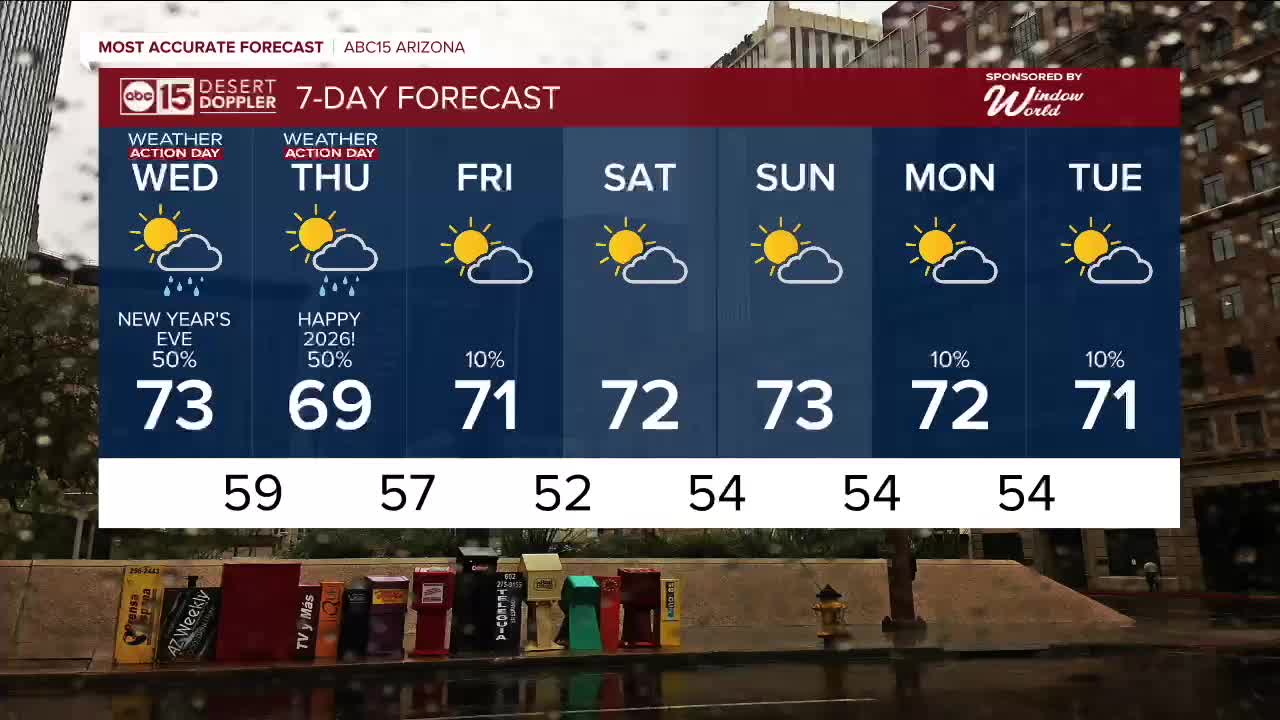
This incoming storm could affect holiday travel and celebrations, so Wednesday and Thursday are ABC15 Weather Action Days as a reminder to take action and adjust outdoor plans as needed.
Here in the Valley, we could see a tenth to a quarter of an inch of rain in some neighborhoods on New Year's Eve and early New Year's Day.
Up north, snow levels will stay high at 9,000 and 10,000 feet, so only the highest peaks will see any. Even in Flagstaff, this storm will bring mostly rain.
Temperatures will drop a few degrees, bringing Valley highs down into the upper 60s on New Year’s Day.
There's a slight chance of a few lingering showers into early Friday, then this storm system will clear out.
We are tracking a couple more weak storms that could bring chances for spotty showers back as early as Sunday. We'll keep you posted as we get closer.


2025 Sky Harbor Official Rainfall to date: 8.31" (+1.09" from average)
Monsoon 2025 Sky Harbor Official Rainfall: 2.76" (+0.33" from average)
__________________________________________
Daily rainfall reports from all across the Valley can be found here.
__________________________________________
PHOENIX IS GETTING DRIER - LOWER RAINFALL AVERAGES NOW
Average Monsoon Rainfall in Phoenix (1981-2010): 2.71" of rain
NEW Average Monsoon Rainfall in Phoenix (1991-2020): 2.43" of rain
Average Yearly Rainfall in Phoenix (1981-2010): 8:03" of rain
NEW Average Yearly Rainfall in Phoenix (1991-2020): 7.22" of rain
__________________________________________
Share your weather photos and videos with us anytime: share@abc15.com.
______________________________________
