

PHOENIX — Monsoon moisture has been surging into the Valley, dumping heavy rain in several spots.
Parts of northeast Scottsdale have already picked up nearly two inches!
Beyond the rain, some neighborhoods have also faced gusty winds, blowing dust, lightning, and flooding.
In fact, flooding could also be an issue in the high country today. A Flood Watch is up for parts of the Kaibab Plateau, including recently burned areas near the North Rim of the Grand Canyon.
We’re likely not done yet in the Valley, either!
More storms could fire up later this evening, bringing all the classic monsoon hazards: strong winds, reduced visibility in blowing dust, heavy downpours, localized flooding, and dangerous lightning.
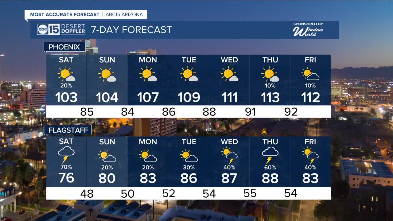
Storm chances fade over the weekend as highs return to around 105 degrees in Phoenix.
High pressure returns next week, pushing temperatures back above 110 by Wednesday and Thursday.


2025 Sky Harbor Official Rainfall to date: 1.63" (-2.68" from average)
Monsoon 2025 Sky Harbor Official Rainfall: 0.16" (-1.20" from average)
__________________________________________
Daily rainfall reports from all across the Valley can be found here.
__________________________________________
PHOENIX IS GETTING DRIER - LOWER RAINFALL AVERAGES NOW
Average Monsoon Rainfall in Phoenix (1981-2010): 2.71" of rain
NEW Average Monsoon Rainfall in Phoenix (1991-2020): 2.43" of rain
Average Yearly Rainfall in Phoenix (1981-2010): 8:03" of rain
NEW Average Yearly Rainfall in Phoenix (1991-2020): 7.22" of rain
__________________________________________
Share your weather photos and videos with us anytime: share@abc15.com.
______________________________________
