

PHOENIX — Monsoon storm chances continue across Arizona!
Any storms that move in could bring gusty winds, blowing dust, frequent lightning and heavy downpours that could lead to flooding.
We are also tracking a Flood Watch in effect through Tuesday evening for the Kaibab Plateau, including the Dragon Bravo Fire burn scar.
With plenty of moisture and slow-moving storms, flooding is possible in washes, creeks, and low-lying areas.
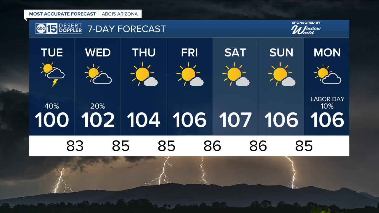
Here in the Valley, after a wild night on storms on Monday, there's still a chance for more on Tuesday.
Storm chances will decrease toward the middle to end of the week as drier air moves in, but they could return to the Valley by Labor Day.


2025 Sky Harbor Official Rainfall to date: 1.68" (-2.92" from average)
Monsoon 2025 Sky Harbor Official Rainfall: 0.21" (-1.44" from average)
__________________________________________
Daily rainfall reports from all across the Valley can be found here.
__________________________________________
PHOENIX IS GETTING DRIER - LOWER RAINFALL AVERAGES NOW
Average Monsoon Rainfall in Phoenix (1981-2010): 2.71" of rain
NEW Average Monsoon Rainfall in Phoenix (1991-2020): 2.43" of rain
Average Yearly Rainfall in Phoenix (1981-2010): 8:03" of rain
NEW Average Yearly Rainfall in Phoenix (1991-2020): 7.22" of rain
__________________________________________
Share your weather photos and videos with us anytime: share@abc15.com.
______________________________________
