

PHOENIX — Monsoon storms remained mostly confined to higher elevations Saturday. While we continue to monitor outflow boundaries tonight, storm chances in the Valley are low. However, blowing dust remains a possibility.
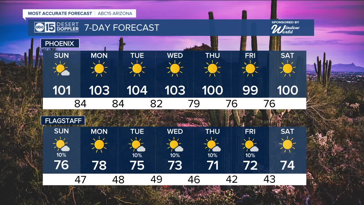
Humidity will remain elevated at the surface on Sunday with high temperatures around 100 degrees, so expect quite the sweat for any outdoor activities. This humid air will gradually decrease through midweek.
Drier air aloft, carried in by westerly winds, is reducing storm chances. A few isolated showers are possible Sunday, mainly in the higher terrain. The Valley will remain dry.
By Monday, most areas will see sunnier and more stable conditions will start the week as high pressure is building. This will push temperatures closer to seasonal averages for the first half of the week.
By midweek, a low-pressure system off the California coast is forecast to move inland, shifting the high eastward. This change will bring a slight drop in temperatures and a more significant decrease in humidity later in the week.
As the pattern shifts, a few isolated storms may develop midweek over higher elevations and parts of eastern Arizona.


_________________________________________
2025 Sky Harbor Official Rainfall to date: 2.15" (-2.78" from average)
Monsoon 2025 Sky Harbor Official Rainfall: 0.68" (-1.31" from average)
__________________________________________
Daily rainfall reports from all across the Valley can be found here.
__________________________________________
PHOENIX IS GETTING DRIER - LOWER RAINFALL AVERAGES NOW
Average Monsoon Rainfall in Phoenix (1981-2010): 2.71" of rain
NEW Average Monsoon Rainfall in Phoenix (1991-2020): 2.43" of rain
Average Yearly Rainfall in Phoenix (1981-2010): 8:03" of rain
NEW Average Yearly Rainfall in Phoenix (1991-2020): 7.22" of rain
__________________________________________
Share your weather photos and videos with us anytime: share@abc15.com.
______________________________________
