

PHOENIX — Big changes are on the way more monsoon moisture returns to Arizona this week!
At the same time, a storm system will be approaching from the west and tapping into some remnant moisture from Tropical Depression Mario.
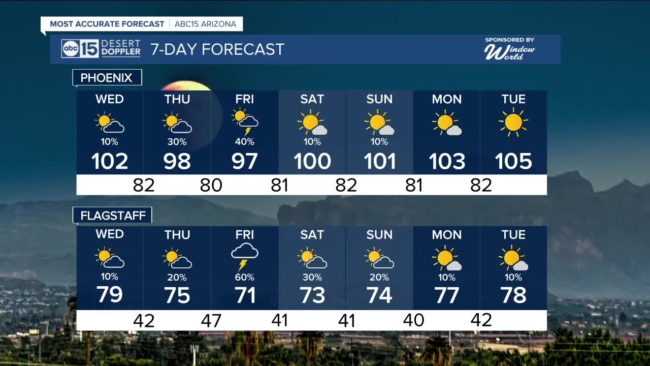
All of those factors could combine to bring severe weather to parts of our state.
Here in the Valley, chances for showers and thunderstorms will increase quite a bit Thursday evening through Friday evening.
Watch out for gusty winds, blowing dust, dangerous cloud-to-ground lightning strikes and heavy downpours that could lead to localized flooding with any of the storms that move through.
Temperatures will drop into the 90s Thursday and Friday, but it will be very humid as that moisture moves in.
As high pressure returns over the weekend and early next week, the forecast looks hotter and drier across Arizona.
Phoenix will be back in the low 100s on Saturday and Sunday.


2025 Sky Harbor Official Rainfall to date: 2.15" (-2.97" from average)
Monsoon 2025 Sky Harbor Official Rainfall: 0.68" (-1.51" from average)
__________________________________________
Daily rainfall reports from all across the Valley can be found here.
__________________________________________
PHOENIX IS GETTING DRIER - LOWER RAINFALL AVERAGES NOW
Average Monsoon Rainfall in Phoenix (1981-2010): 2.71" of rain
NEW Average Monsoon Rainfall in Phoenix (1991-2020): 2.43" of rain
Average Yearly Rainfall in Phoenix (1981-2010): 8:03" of rain
NEW Average Yearly Rainfall in Phoenix (1991-2020): 7.22" of rain
__________________________________________
Share your weather photos and videos with us anytime: share@abc15.com.
______________________________________
