

PHOENIX — Our forecast is starting to dry out across Arizona as high pressure builds in.
That will also heat things up in the Valley over the next few days.
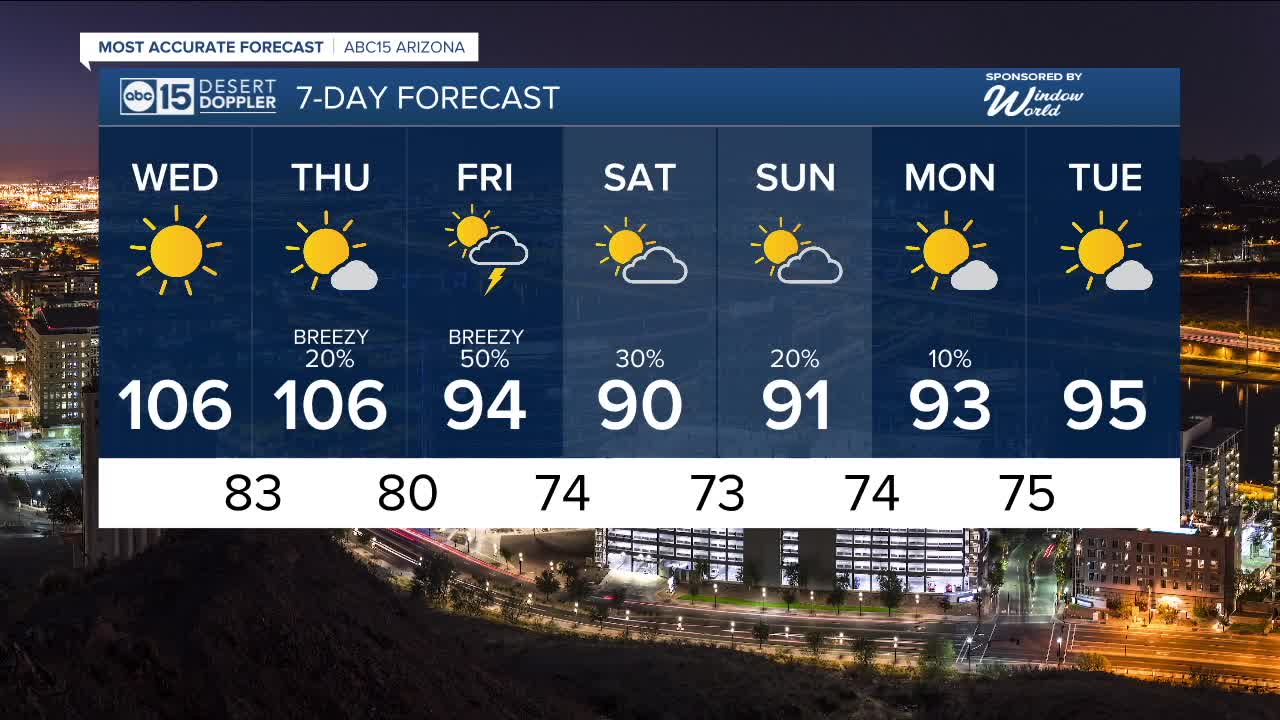
Temperatures could top 105 degrees by Wednesday and Thursday, putting us within a few degrees of the daily records.
Heat like this in late September will put our risk for heat exhaustion and heat stroke in the moderate to major range, so take it easy if you’re outside. Drink plenty of water and seek shade as much as you can.
Breezes will start to pick up Thursday as our next storm system approaches.
That storm will drop temperatures more than 10 degrees by Friday as breezes continue, and we'll see chances for showers and thunderstorms across Arizona too.
Here in the Valley, storm chances will start Thursday evening, ramp up into Friday, and continue over the weekend.
With just a week left in the monsoon season, these are our last chances to get rain in the gauges. Phoenix is more than an inch below normal so far this monsoon.
This storm will bring a nice cool-down over the weekend, too.
Look for Valley highs in the low 90s on Saturday and Sunday with overnight lows in the low to mid 70s.


2025 Sky Harbor Official Rainfall to date: 2.38" (-2.87" from average)
Monsoon 2025 Sky Harbor Official Rainfall: 0.91" (-1.40" from average)
__________________________________________
Daily rainfall reports from all across the Valley can be found here.
__________________________________________
PHOENIX IS GETTING DRIER - LOWER RAINFALL AVERAGES NOW
Average Monsoon Rainfall in Phoenix (1981-2010): 2.71" of rain
NEW Average Monsoon Rainfall in Phoenix (1991-2020): 2.43" of rain
Average Yearly Rainfall in Phoenix (1981-2010): 8:03" of rain
NEW Average Yearly Rainfall in Phoenix (1991-2020): 7.22" of rain
__________________________________________
Share your weather photos and videos with us anytime: share@abc15.com.
______________________________________
