

PHOENIX — Extreme heat continues to grip the Valley.
Our Extreme Heat Warning has been extended once again and is now in effect until 8 p.m. Wednesday.
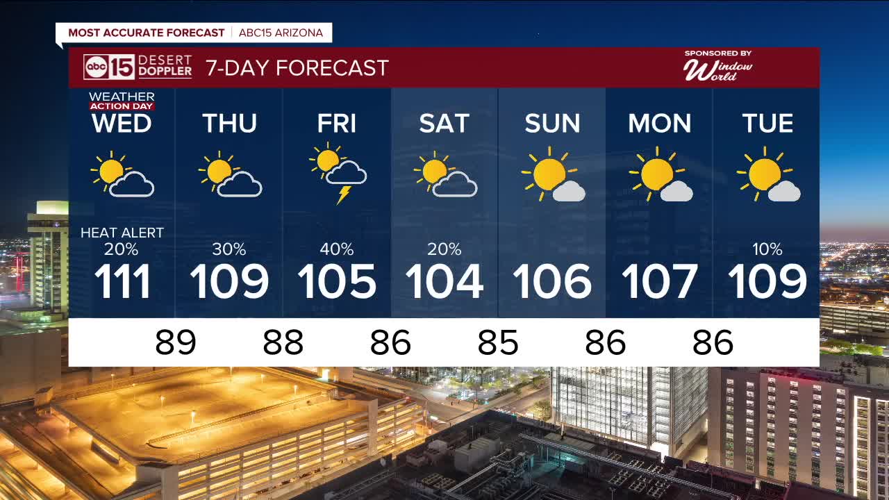
That means Wednesday will be another ABC15 Weather Action Day as a reminder to take action to protect yourself, your loved ones and your pets.
Avoid contact with hot surfaces such as car doors, steering wheels, and playground equipment. They can cause serious burns within seconds.
An Extreme Heat Warning is also in effect across western Arizona, along the Colorado River, until 8 p.m. Wednesday and for the lower elevations of the Grand Canyon below 4,000 feet through Thursday evening.
A Heat Advisory is also in place for the Northwest Plateau of Mohave County through 8 p.m. Wednesday.
Temperatures will gradually drop toward the end of the week as monsoon moisture surges in and storm chances ramp up.
Here in the Valley, we could see a few isolated storms overnight or even Wednesday evening, but the best chances will be Thursday and Friday.
Watch out for all the typical monsoon storm threats, such as gusty winds, blowing dust, pockets of heavy rain that could lead to localized flooding, and dangerous lightning strikes.
Monsoon storm chances will gradually taper off over the weekend, but could return again next week.


2025 Sky Harbor Official Rainfall to date: 1.63" (-2.59" from average)
Monsoon 2025 Sky Harbor Official Rainfall: 0.16" (-1.11" from average)
__________________________________________
Daily rainfall reports from all across the Valley can be found here.
__________________________________________
PHOENIX IS GETTING DRIER - LOWER RAINFALL AVERAGES NOW
Average Monsoon Rainfall in Phoenix (1981-2010): 2.71" of rain
NEW Average Monsoon Rainfall in Phoenix (1991-2020): 2.43" of rain
Average Yearly Rainfall in Phoenix (1981-2010): 8:03" of rain
NEW Average Yearly Rainfall in Phoenix (1991-2020): 7.22" of rain
__________________________________________
Share your weather photos and videos with us anytime: share@abc15.com.
______________________________________
