



PHOENIX — An area of low pressure is bringing another round of showers and thunderstorms to Arizona this weekend.
This storm will clear out by Sunday and you can expect drier weather as we head into the new week.
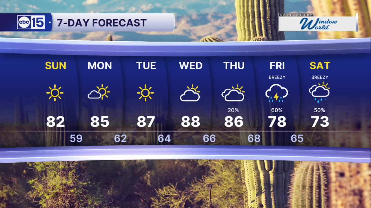
Temperatures will climb into to low to mid 80s on Sunday and Monday, before reaching the mid to upper 80s through midweek.
Overnight lows will be comfortably cool, falling into the upper 50s to low 60s each morning across the Valley.
Clouds move back in by Wednesday and we could see a river of moisture set up across our region by late week, bringing rain chances back.
As of now it looks like rain chances return Thursday with more widespread showers and thunderstorms possible by Friday.
Showers and storms could linger into the Halloween weekend, so stay tuned for updates as we get closer.


2026 Sky Harbor Official Rainfall to date: 3.20" (-2.57" from average)
Monsoon 2026 Sky Harbor Official Rainfall: 2.46" (+0.03" from average)
__________________________________________
Daily rainfall reports from all across the Valley can be found here.
__________________________________________
PHOENIX IS GETTING DRIER - LOWER RAINFALL AVERAGES NOW
Average Monsoon Rainfall in Phoenix (1981-2010): 2.71" of rain
NEW Average Monsoon Rainfall in Phoenix (1991-2020): 2.43" of rain
Average Yearly Rainfall in Phoenix (1981-2010): 8:03" of rain
NEW Average Yearly Rainfall in Phoenix (1991-2020): 7.22" of rain
__________________________________________
Share your weather photos and videos with us anytime: share@abc15.com.
______________________________________
